
Home » Posts tagged 'mineralisation'
Tag Archives: mineralisation
#URU URU Metals Ltd – Zeb Nickel Project 3D Modelling
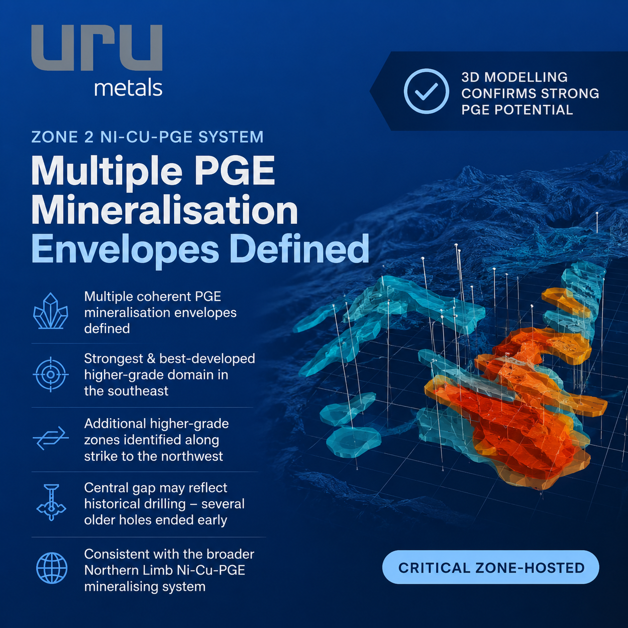 URU Metals Limited (“URU” or the “Company”) is pleased to provide a further update on the ongoing 3D geological modelling programme at the Zeb Nickel Project in Limpopo, South Africa.
Atticus Geoscience has now completed the first stage of 3D mineralisation modelling of the Project’s Zone 2 Ni-Cu-PGE system using historical and recent drill hole data.
The modelling has defined multiple coherent PGE mineralisation envelopes within the Critical Zone rocks and has highlighted a well-developed higher-grade mineralised domain in the southeast of the Project, together with further mineralised zones extending along strike towards the northwest.
Highlights
· 3D modelling has defined multiple coherent PGE mineralisation envelopes within the Critical Zone-hosted Zone 2 Ni-Cu-PGE system.
· The mineralisation is hosted predominantly within the Critical Zone pyroxenitic package.
· The strongest and best-developed higher-grade mineralised domain occurs in the southeast of the Project area, where drilling density is also greatest.
· Additional higher-grade mineralised zones have been identified along strike towards the northwest.
· The apparent break in mineralisation through parts of the central area may reflect the historical drilling pattern, as several older boreholes terminated before reaching the Critical Zone.
· The geological setting and style of Zone 2 mineralisation are consistent with the broader Northern Limb Ni-Cu-PGE mineralising system represented by Ivanhoe Mines’ Platreef Mine and Valterra Platinum’s Mogalakwena Mining Complex.
· The higher-grade mineralisation lies close to the interpreted chonolith and conduit system between the Uitloop I and Uitloop II ultramafic bodies.
· This relationship provides an important exploration vector, as repeated magma flow through the interpreted plumbing system may have created favourable conditions for sulphide saturation and concentration of Ni-Cu-PGE mineralisation.
· Future drilling will initially focus on the better-developed higher-grade areas in the southeast, with the aim of generating sufficient drilling to support a maiden mineral resource for Zone 2.
· Subsequent step-out drilling will test the central area and the possible continuity between the southeastern and northwestern mineralised domains.
· Ground FDEM Target 1 remains a separate high-priority drill target for semi-massive to massive sulphides within the interpreted chonolith system.
Zone 2 Mineralisation Model
Atticus has used the available Pt, Pd and Rh assay data to construct three-dimensional mineralisation envelopes through the Zone 2 Critical Zone.
For modelling purposes, a 3PGE grade of 0.08 g/t Pt+Pd+Rh was used to define the broader mineralised envelope, while 0.5 g/t 3PGE was used to identify the higher-grade mineralised population. These thresholds are modelling parameters and are not mineral resource cut-off grades.
The resulting model shows that Zone 2 mineralisation is concentrated predominantly within the Critical Zone pyroxenitic package and associated Marginal Facies.
The higher-grade mineralisation is best developed in the southeastern part of the Project, where the current drilling density is greatest. Additional higher-grade mineralised areas occur along strike towards the northwest.
Importantly, the apparent reduction in mineralisation through parts of the central area may not represent a genuine geological break. Several historical boreholes in this area terminated before reaching the interpreted Critical Zone, leaving a material portion of the prospective horizon effectively untested.
The southeastern area also contains the highest PGE grades currently represented in the model, with drilling having intersected grades of up to approximately 6 g/t 3PGE+Au.
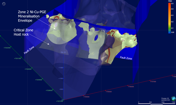
Figure 1: PGE mineralisation envelopes within the Critical Zone rocks.

Figure 2: PGE mineralisation envelopes within the Critical Zone rocks, showing a well-developed higher-grade mineralised domain in the southeastern part of the Project area.
Northern Limb Context
The style of Zone 2 mineralisation being modelled at Zeb is consistent with the broader Ni-Cu-PGE mineralising environment of the Northern Limb of the Bushveld Complex.
Approximately the same regional geological package hosts Ivanhoe Mines’ Platreef deposit and Valterra Platinum’s Mogalakwena Mining Complex, both of which contain substantial PGM mineralisation with associated nickel and copper within thick, pyroxenite-rich intrusive sequences.
Ivanhoe describes the Platreef mineralised sequence as comprising norite, pyroxenite and harzburgite, with its principal mineralised units correlated with the Upper Critical Zone of the Bushveld Complex. At Mogalakwena, Valterra describes the Platreef as a thick, heterogeneous mafic package dominated by pyroxenite and norite, with significant nickel and copper associated with the PGM mineralisation.
URU has previously highlighted the similarity between these Northern Limb mineralisation styles and the Critical Zone-hosted Ni-Cu-PGE mineralisation intersected at Zeb. The new 3D modelling strengthens this interpretation by demonstrating coherent mineralised envelopes within the Critical Zone pyroxenitic package rather than isolated mineralised drill intersections.
Relationship to the Chonolith System
A further important outcome of the modelling is the spatial relationship between the higher-grade Zone 2 mineralisation and the interpreted chonolith and conduit system between the Uitloop I and Uitloop II ultramafic bodies.
The higher-grade mineralised envelopes occur relatively close to these interpreted intrusive conduits.
This is consistent with the Company’s broader geological model for Zeb. Repeated or sustained magma flow through a chonolith-style plumbing system may have promoted sulphide saturation and provided favourable conditions for the development and concentration of Ni-Cu-PGE mineralisation.
The relationship between the mineralised envelopes and the interpreted plumbing system gives the Company an additional geological vector for future drilling and will be considered together with the airborne and ground EM responses, gravity and magnetic data and the 3D intrusive model.

Figure 3: Spatial relationship between the higher-grade Zone 2 mineralisation and the interpreted chonolith and conduit system connecting the Uitloop I and Uitloop II ultramafic bodies.
Building Towards a Maiden Zone 2 Resource
The completed mineralisation model gives the Company a much clearer basis for planning the next phase of drilling.
Initial drilling will focus on the better-developed higher-grade southeastern mineralised domain, where the objective will be to increase drill density and test extensions to the known mineralisation.
The Company intends to use this work to build sufficient geological continuity and drilling density to support a maiden mineral resource estimate for Zone 2.
Further step-out drilling will then test the central area between the southeastern and northwestern mineralised zones. This work will determine whether the currently modelled domains are separate bodies or parts of a more continuous Critical Zone mineralised system that has simply not been adequately tested by the historical drilling.
Ground FDEM Target 1 remains a separate high-priority exploration target. The discrete conductor sits within the interpreted chonolith system at a favourable change in intrusive geometry and will be tested for a possible concentration of semi-massive to massive Ni-Cu-PGE sulphides.
The Company’s geological team will now use the completed mineralisation model, together with the airborne and ground EM, gravity and magnetic datasets, to finalise and rank the proposed drill holes within the available exploration budget.
Richard Montjoie, Exploration Manager of URU Metals, commented:
“Simon’s work has now given us a proper 3D view of where the Zone 2 mineralisation sits and, importantly, where the higher-grade parts of the system are developing.
The southeast is clearly the most advanced area and gives us a sensible place to start building towards a maiden Zone 2 resource. We are also seeing mineralisation continuing along strike to the northwest, while much of the ground in between has simply not been properly tested because a number of the historical holes stopped short.
The Critical Zone setting is also important. This is the same broad geological environment that hosts the Ni-Cu-PGE mineralisation at Ivanhoe’s Platreef and Valterra’s Mogalakwena operations nearby. We have talked about that relationship for some time, but the Leapfrog work is now allowing us to see the geometry of the Zeb mineralisation properly in three dimensions.
The fact that the higher-grade envelopes also sit close to the interpreted chonolith system fits well with our geological model and gives us another vector for drilling. We now have a much clearer strategy: build out the higher-grade Zone 2 mineralisation towards a maiden resource, test whether those mineralised areas connect through the central gap, and drill Target 1 for the more concentrated sulphide target.”
ENDS
For further information, please contact:
URU Metals Limited
John Zorbas
Chief Executive Officer
+1 416 504 3978
SP Angel Corporate Finance LLP
Nominated Adviser and Broker
Ewan Leggat / Caroline Rowe
+44 (0) 203 470 0470
Axis Capital Markets Limited
Joint Broker
Richard Hutchison
+44 (0) 203 026 0320
Market Abuse Regulation (MAR) Disclosure
This announcement contains inside information for the purposes of Article 7 of the Market Abuse Regulation (EU) No. 596/2014 as it forms part of United Kingdom domestic law by virtue of the European Union (Withdrawal) Act 2018 (“UK MAR”). Upon the publication of this announcement via a Regulatory Information Service, this inside information is now considered to be in the public domain.
#GRX GreenX Metals Limited – Quarterly Activities Report June 2026
 GreenX Metals Limited (ASX:GRX, LSE:GRX, GPW:GRX, Germany-FSE:A3C9JR) (GreenX or the Company) is pleased to present its Quarterly Activities Report for the period ending and subsequent to 30 June 2026.
SUMMARY
· TANNENBERG COPPER PROJECT (GERMANY)
o EXPLORATION TARGET:
o Exploration Target announced demonstrates potential for a globally significant copper endowment at Tannenberg.
o Exploration Target captures hanging wall and footwall mineralisation above and below the Kupferschiefer shale: a modern view of the deposit that the 1940 historical estimate did not contemplate.
o Validated by Kupferschiefer mining in Poland, where up to 95% of mineable copper at KGHM Polska Miedź S.A’s operations is hosted in the same footwall sandstone and hanging wall limestone units that host the Tannenberg Exploration Target.
o Built on validated historical foundations: the Exploration Target builds on the 1940 National Socialist historical estimate area; the 1984 St Joe historical estimate; validation via resampling and logging of 1980’s core by GreenX and digitised archive material collected since August 2024.
o An inflection point for Tannenberg: with the Exploration Target estimated, GreenX now transitions from archive synthesis to active exploration, including Scoping Study-level metallurgical test work, a seismic survey and commencement of an initial drill program.
o Work completed by Palsatech in a specialist logging facility in Sweden with MSA Mining Consulting UK Ltd’s independent competent person compiling the Exploration Target.
o MINERALOGY AND PROCESSING STUDY:
o Subsequent to the Exploration Target, GreenX completed an early-stage mineralogy and processing study for Tannenberg.
o Mineralogy study confirms Tannenberg mineralisation is consistent with producing Polish Kupferschiefer mines
o Independent metallurgical review by MSA Mining Consulting UK confirms Tannenberg confirms potential suitability for a conventional flotation-based processing route, as used at KGHM’s (WSE:KGH) long-running operations and planned for Lumina Metals’ (TSE:LMCU) Nowa Sól project.
o Established Kupferschiefer flowsheet provides a baseline processing route for Tannenberg. KGHM’s operations process 30 Mtpa at 1.6% Cu and 45 g/t Ag, achieving 89% copper and 86% silver aggregate recovery from a blended feed of Kupferschiefer shale, sandstone and carbonate-hosted mineralisation using crushing, two-stage grinding, rougher flotation, fine regrinding and multi-stage cleaning.
o Modern processing technologies offer potential to enhance recoveries. Advances, including high-pressure grinding rolls, fine-particle flotation systems and advanced reagent schemes, will be investigated, with potential to improve liberation and recovery of fine-grained copper sulphides relative to legacy flowsheets developed decades ago for KGHM.
o The mineralogy study, completed by SGS Lakefield on ten drill core samples, shows that the copper is predominantly hosted in chalcocite with additional bornite, chalcopyrite and covellite, typical of Kupferschiefer deposits.
o Bi-modal copper sulphide grain size distribution identified, with both coarse (>25 to 30 µm) and very fine disseminated material (<5 to 10 µm), informing comminution and flotation circuit design.
o Historical extraction at Tannenberg materially de-risks metallurgy. The Tannenberg mines produced 416,500 tonnes of copper and 33.7 Moz of silver predominantly during the 1930’s to 50’s, when mineral processing technology was not as advanced as it is in modern times.
o Supports progression to scoping-level metallurgical testwork on representative samples of each lithology to seek to confirm initial mineralogical findings, assess comminution characteristics and evaluate flotation performance.
· ELEONORE NORTH PROJECT (GREENLAND)
o Fieldwork is currently underway at Eleonore North, targeting gold, tungsten and antimony mineralisation.
o A Reduced Intrusion-related Gold System specialist evaluating the Noa Pluton prospect as well as untested targets
o Bulk sampling of tungsten and antimony-mineralised material at North and South Margeries deposits is expected to support scoping-study level metallurgical sighter test work.
o Archive core from North and South Margeries deposits was sampled prior to fieldwork and are currently being assayed with results expected in the coming months.
o Aim of fieldwork in 2026 is to confirm drill ready targets at both North and South Margeries and Noa Pluton.
o Multiple walk-up surface anomalies identified along strike and adjacent to the existing high-grade tungsten and antimony historical estimates previously identified.
o A 2 km-long prospectivity anomaly at North Margeries sits adjacent to a major east-west fault structure, with multiple additional anomalies surrounding the South Margeries historical estimate.
o Targets were generated by applying modern processing techniques to a heritage dataset acquired from an airborne hyperspectral survey flown in 2000 across the East Greenland Licences.
o Tungsten and antimony are both listed as critical raw materials by the European Union and the United States, with global supply heavily concentrated in China.
· ARBITRATION SET-ASIDE PROCEEDINGS
o As previously announced, the Singapore Court rejected, in its entirety, Poland’s application to set aside the Company’s ECT award, thereby upholding GreenX’s previously announced right to compensation under the ECT.
o A redacted judgment has been released by the Singapore Court, and the Company has brought the judgment to the attention of the English courts as part of the BIT set-aside proceedings. Under the English Arbitration Act 1996, the threshold to succeed on a set-aside application in the courts of England and Wales is exceptionally high, and courts typically reject these challenges unless there has been a serious procedural irregularity.
o Poland has applied to the Singapore Court of Appeal to challenge the rejection of the first ECT set-aside motion. This appeal is being heard in September 2026 by the Court of Appeal, following which Poland will have no further rights of appeal within the Singapore courts.
o The Company will continue to defend its awards and update the market in line with its continuous disclosure requirements.
ENQUIRIES
|
Ben Stoikovich Chief Executive Officer
+44 207 478 3900 |
Kazimierz Chojna Investor Relations – Poland
Kim Eckhof Investor Relations – UK / Germany |
Link here to view the full announcement
#GRX GreenX Metals LTD – Study Finds Tannenberg Consistent with Polish Mine
 HIGHLIGHTS

· Tannenberg mineralisation consistent with producing Polish Kupferschiefer copper-silver mines. Review by independent metallurgist from MSA Mining Consulting UK confirms potential suitability for a conventional flotation-based processing route, as used at KGHM’s (WSE:KGH) long-running operations and planned for Lumina Metals’ (TSE: LMCU) Nowa Sól project
· Established Kupferschiefer flowsheet provides baseline processing route for Tannenberg. KGHM’s operations process 30 Mtpa at 1.6% Cu and 45 g/t Ag, achieving 89% copper and 86% silver aggregate recovery from a blended feed of Kupferschiefer shale, sandstone and carbonate-hosted mineralisation using crushing, two-stage grinding, rougher flotation, fine regrinding and multi-stage cleaning
· Modern processing technologies offer potential to enhance recoveries. Advances, including high-pressure grinding rolls (HPGR), fine-particle flotation systems and advanced reagent schemes, will be investigated, with potential to improve liberation and recovery of fine-grained copper sulphides relative to legacy flowsheets developed decades ago for KGHM
· Mineralogy study completed by SGS Lakefield on ten drill core samples. This study shows that the copper is predominantly hosted in chalcocite with additional bornite, chalcopyrite and covellite, typical of Kupferschiefer deposits
· Bi-modal copper sulphide grain size distribution identified, with both coarse (>25-30 µm) and very fine disseminated material (<5-10 µm), informing comminution and flotation circuit design
· Historical extraction at the Tannenberg Project materially de-risks metallurgy. The Tannenberg mines produced 416,500 tonnes of copper and 33.7 Moz of silver predominantly during the 1930’s – 50’s, when mineral processing technology was not as advanced as it is in modern times
· Supports progression to scoping-level metallurgical testwork on representative samples of each lithology to seek to confirm initial mineralogical findings, assess comminution characteristics and evaluate flotation performance
GreenX Metals Limited (ASX:GRX, LSE:GRX, GPW:GRX, Germany-FSE:A3C9JR) (GreenX or the Company) is pleased to announce that it has completed an early-stage mineralogy and processing study for its Tannenberg Copper Project (Tannenberg or the Project) in Germany. The mineralogy study was completed by SGS Canada Inc. at its Lakefield Ontario facility (SGS Lakefield). It was followed by an independent metallurgical review undertaken by MSA Mining Consulting UK Ltd (MSA-UK) through Principal Associate Metallurgist, Mr Gordon Cunningham. The review has benchmarked Tannenberg against operating and development Kupferschiefer mines in Poland, confirming that copper mineralisation at Tannenberg is consistent with copper-silver deposits in the region and is considered amenable to conventional flotation-based processing methods.
GreenX’s Chief Executive Officer, Mr Ben Stoikovich, commented: “This mineralogy study confirms that the copper is contained in the same size and style of minerals as the producing Polish Kupferschiefer mines. This independent review supports a potential conventional flotation processing route, which reduces technical risk at this early stage. This gives us confidence that Tannenberg appears to have the right ingredients to follow a proven development pathway, and we will advance metallurgical test work to unlock that potential.”
TYPICAL PROCESSING METHODS – KUPFERSCHIEFER OPERATIONS (KGHM AND LUMINA METALS ANALOGUES)
The sediment-hosted (Kupferschiefer) copper-silver deposits in Poland provide a well-established processing analogue for GreenX’s Tannenberg Project, with both long-running operations at KGHM and a recent Preliminary Economic Assessment (PEA) for Lumina Metals’ Nowa Sól Project applying similar flotation-based processing routes with selective regrinding.
At KGHM’s operations, approximately 30 Mtpa of ore is treated from the Kupferschiefer sequence at an average feed grade of around 1.6% copper and 45 g/t silver. The plant processes a blended feed comprising Kupferschiefer shale, sandstone and carbonate-hosted mineralisation. Processing is based on a conventional sulphide flotation flowsheet, starting with crushing followed by two-stage grinding (rod-ball or ball-ball milling) to a primary grind size of approximately 75 µm (Source: KGHM, Micon, 2013 (see Appendix 2)).
Following grinding, the slurry is treated through flotation circuits consisting of two stages of rougher flotation. The rougher concentrate is then reground to a much finer size, typically less than 20 µm, before passing through multi-stage cleaning circuits. This combination of initial grinding and subsequent fine regrinding is critical to liberate the fine-grained copper sulphide minerals characteristic of Kupferschiefer deposits. The process produces a copper concentrate grading approximately 23% Cu and containing significant silver, with typical metallurgical performance of around 89% copper recovery and 86% silver recovery. The final concentrate is then transported to smelting and refining facilities, where copper metal is produced and silver and other by-products are recovered.
The PEA stage Nowa Sól Cu-Ag Project, owned by Lumina Metals and located within the same Kupferschiefer belt as both Tannenberg and the KGHM mines, provides a modern comparison and follows a similar processing philosophy (Source: Lumina Metals, Micon, 2026 (see Appendix 2)). The proposed flowsheet incorporates semi-autogenous grinding (SAG) with ball milling and pebble crushing, targeting a primary grind size of approximately 60 µm, followed by flotation processing. As with KGHM, the flotation circuit includes two stages of rougher flotation, with the rougher concentrate subjected to fine regrinding (to approximately 11 µm) and multiple cleaning stages to improve concentrate grade and recovery.
The Nowa Sól flowsheet is designed to produce a copper concentrate grading greater than 26% Cu, with strong silver credits (in excess of 1,200 g/t Ag), and expected recoveries of more than 88% for copper and approximately 86% for silver. The final concentrate is planned to be thickened and filtered prior to sale.
Together, these operating and development analogues demonstrate that Kupferschiefer mineralisation can be successfully processed using conventional flotation circuits that incorporate fine grinding, concentrate regrinding and multi-stage cleaning. They also highlight the importance of achieving sufficient liberation of fine-grained copper minerals, a key factor in maximising recovery and concentrate quality in this style of deposit. In the cases of both KGHM and Lumina, there remains a strong opportunity to refine and optimise the flowsheets. In KGHM’s case, the plant was built many decades ago, and the Lumina flowsheet used a limited amount of sample material.
COMPARISON OF TANNENBERG COPPER-SILVER MINERALISATION WITH POLISH ANALOGUES
The new mineralogical work was completed by SGS Lakefield on ten selected historical drill core samples distributed throughout the mineralised area (Figure 1). The analysis covered three types of mineralisation, including shale, sandstone and carbonate (Figure 2) and provided confirmation of the deportment of the Tannenberg mineralisation, allowing for an important comparison to the Polish deposits. The study utilised TESCAN Integrated Mineral Analyzer (TIMA) and Scanning Electron Microscopy (SEM) techniques to characterise mineral composition, grain size and liberation behaviour.
The results indicate that copper mineralisation is dominated by chalcocite, with additional contributions from bornite, chalcopyrite and covellite, together with minor pyrite, galena and sphalerite. Copper occurs across Kupferschiefer shale, sandstone and carbonate lithologies, with the shale generally hosting the highest grades.
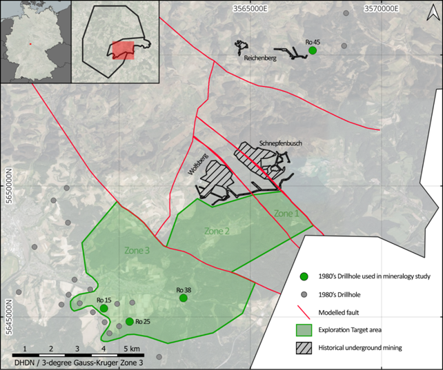
Figure 1: Map showing location of drill holes, indicating those used in the mineralogy study.
A key outcome of the study is the identification of a distinctly bi-modal grain size distribution of copper sulphides, with both coarse particles (>25-30 µm) and very fine disseminated material (<5-10 µm) present within the host rocks. This fine-grained component is pervasive, with all analysed sections containing copper mineralisation below 5 µm. The presence of this bi-modal distribution is considered a critical factor influencing comminution requirements, flotation performance and overall metallurgical recovery.
When compared to Polish Kupferschiefer operations and development projects, the Tannenberg mineralisation shows strong similarities in grain-size distribution. The presence of fine and disseminated sulphide mineralisation is consistent with observations from these analogue deposits, where fine grinding and regrinding are required to achieve adequate liberation.
Hole:Ro 45 |
268.34 mKupferschiefer |
269.00 mKupferschiefer |
269.63 mFootwall Grauligend |
Hole:Ro 25 |
533.38 mKupferschiefer |
533.89 mKupferschiefer |
|
Hole:Ro 15 |
286.24 mHanging wall Limestone |
287.00 mHanging wall Limestone |
288.20 mHanging wall Limestone |
Hole:Ro 38 |
536.66 mKupferschiefer |
539.00 mFootwall Grauligend |
|
|
|
|||
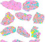
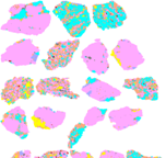
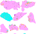
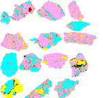
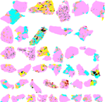
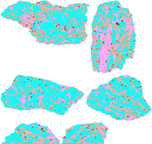
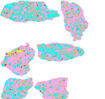
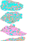
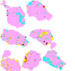
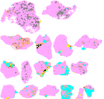


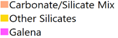
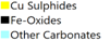


Figure 2: Copper sulphide gangue mineral association images for the ten samples which formed part of the study. The width of each image is 1.5mm.
Based on these similarities, conventional flotation processing is considered an appropriate baseline metallurgical approach for Tannenberg. The Polish analogues demonstrate that crushing, primary grinding, flotation, concentrate regrinding and multi-stage cleaning can achieve strong recoveries of copper and silver from Kupferschiefer ores. As with all such operations, the bi-modal grain size distribution identified at Tannenberg suggests that particular attention will need to be given to comminution strategy, including the potential requirement for finer grinding to effectively liberate ultra-fine copper minerals.
The mineralogical data also indicates the presence of organic carbon and minor deleterious elements, which may report to concentrate and influence product quality. As a result, future metallurgical testwork will evaluate additional processing steps, such as carbon pre-flotation or specialised reagent schemes, to optimise concentrate grade and marketability.
The Competent Person and independent metallurgical consultant, Mr Cunningham from MSA-UK, has concluded that the Tannenberg mineralisation is materially similar to Polish analogue ores. The Competent Person considers that the Tannenberg mineralisation is potentially well suited to a flotation-based processing flowsheet and that, subject to further test work, metallurgical recoveries are comparable to, or potentially better than the ~89% Cu and ~86% Ag recoveries reported from Polish mines may be achievable at Tannenberg. The Competent Person also considers that the Project may potentially produce a copper-silver concentrate of a type that could have strong market acceptance. The Competent Person has concluded, with reasonable confidence, that the following material factors support this assessment, subject to further test work:
· This new mineralogy study includes TIMA and SEM analysis conducted on 10 samples from four drill holes, which are considered representative of the Tannenberg mineralisation. The selected drill holes provide good spatial coverage of the target mineralisation, as shown in Figure 1.
· The Tannenberg mineralisation is interpreted to have formed through the same genetic process as the Polish analogue ores, with all projects existing on the same structure and mineral system, the Mid-European Crystalline Zone (please refer to GreenX’s announcement dated 9 September 2025).
· Copper and silver ore-mineral grain size, host mineral associations and other deportment characteristics at Tannenberg have been found to be materially similar to the published data from the Polish analogue ores. These fundamental technical characteristics are key to determining metallurgical recovery.
· Both copper and silver were historically extracted at the Tannenberg Project through mining activities undertaken up to the 1950’s.
· The metallurgical recoveries referenced above are consistent with the 2013 Technical Report prepared by Micron International Limited, an independent consultant to KGHM (Refer to Appendix 2).
· Modern developments in copper processing technologies may provide opportunities to improve overall metallurgical recoveries relative to the KGHM mines, which were constructed in the 1960s.
This initial mineralogical assessment at Tannenberg also highlights the importance of detailed metallurgical testwork to optimise grind size, concentrate quality and recovery for the Project. The shallow depth of the Tannenberg Project, with the existence of spoil heaps and potentially accessible old workings will facilitate metallurgical test work being conducted during early project study phases.
RECENT DEVELOPMENTS IN COPPER PROCESSING TECHNOLOGIES
While Kupferschiefer deposits in Poland have been processed for decades using conventional flotation circuits, more recent technological developments offer opportunities to enhance metallurgical performance.
Advances in comminution technologies, such as HPGR, can improve the liberation of fine-grained copper minerals by breaking ore along natural grain boundaries. This is particularly important for Kupferschiefer mineralisation, where a significant portion of copper occurs in very fine particles.
In addition, modern flotation technologies and specialised fine-particle recovery systems can improve recovery of ultra-fine sulphide minerals, while advanced reagent schemes and pre-treatment steps, such as carbon pre-flotation, may further enhance concentrate grade.
These developments indicate that modern flowsheets have the potential to achieve improved copper and silver recoveries compared to historic operations, particularly for fine-grained Kupferschiefer ores.
Upcoming Work Programs
In addition to the ongoing exploration activities, GreenX will advance the next stage of processing work and focus on scoping-level metallurgical test work using representative samples collected from the key mineralised lithologies. This program will be designed to confirm the initial mineralogical findings, assess comminution characteristics and evaluate flotation performance, including recovery, concentrate grade and reagent selection.
Results from this test work will be used to develop a preliminary metallurgical flowsheet for the Tannenberg Project. This flowsheet will provide the basis for subsequent, more advanced metallurgical programs, including variability testing, optimisation of grind size and flotation conditions, and detailed assessment of concentrate quality and processing performance.
ENQUIRIES
|
Ben Stoikovich Chief Executive Officer |
Kazimierz Chojna Investor Relations – Poland
|
|
+44 207 478 3900 ir@greenxmetals.com |
Kim Eckhof Investor Relations – UK/Germany
|
Competent Persons Statement (Exploration Results)
The information in this announcement that relates to Exploration Results is based on information compiled by Dr Matthew Jackson, a Competent Person who is a Member of the Australasian Institute of Mining and Metallurgy. Dr Jackson is a Technical Consultant for GreenX and is a holder of unlisted options in the Company. Dr Jackson has sufficient experience that is relevant to the style of mineralisation and type of deposit under consideration and to the activity being undertaken, to qualify as a Competent Person as defined in the 2012 Edition of the ‘Australasian Code for Reporting of Exploration Results, Mineral Resources and Ore Reserves’. Dr Jackson consents to the inclusion in this announcement of the matters based on his information in the form and context in which it appears.
Competent Persons Statement (metallurgy MINERALOGY STUDY)
The information in this announcement that relates to Exploration Results (metallurgy mineralogy study) is based on information compiled by Mr Gordon Cunningham, a Competent Person who is a Member of the Engineering Council of South Africa and a Fellow of the South African Institute of Mining and Metallurgy, a Recognised Professional Organisation included in a list promulgated by ASX from time to time. Mr Cunningham is a Technical Consultant for MSA Mining Consulting UK Ltd. Mr Cunningham has sufficient experience that is relevant to the style of mineralisation and type of deposit under consideration and to the activity being undertaken to qualify as a Competent Person as defined in the 2012 Edition of the ‘Australasian Code for Reporting of Exploration Results, Mineral Resources and Ore Reserves’. Mr Cunningham consents to the inclusion in this announcement of the matters based on his information in the form and context in which it appears.
Forward Looking Statements
This release may include forward-looking statements, which may be identified by words such as “expects”, “anticipates”, “believes”, “projects”, “plans”, and similar expressions. These forward-looking statements are based on GreenX’s expectations and beliefs concerning future events. Forward looking statements are necessarily subject to risks, uncertainties and other factors, many of which are outside the control of GreenX, which could cause actual results to differ materially from such statements. There can be no assurance that forward-looking statements will prove to be correct. GreenX makes no undertaking to subsequently update or revise the forward-looking statements made in this release to reflect the circumstances or events after the date of that release.
The information contained within this announcement is deemed to constitute inside information as stipulated under the Regulation 2014/596/EU which is part of domestic law pursuant to the Market Abuse (Amendment) (EU Exit) Regulations (SI 2019/310) (“UK MAR”). By the publication of this announcement via a Regulatory Information Service, this inside information (as defined in UK MAR) is now considered to be in the public domain.
REFERENCES AND SOURCES
Please refer to Appendix 2 below.
Appendix 1: Exploration Results and JORC Tables
Table 1: Historical drill hole information (used for process mineralogy study)
|
Hole ID |
Easting |
Northing |
Elevation (m MSL) |
Dip (°) |
Depth (m) |
|
Ro 15 |
4348595 |
5647200 |
255 |
90 |
351 |
|
Ro 25 |
4349554 |
5646656 |
331 |
90 |
553 |
|
Ro 38 |
4351640 |
5647472 |
249 |
90 |
559 |
|
Ro 45 |
4356946 |
5656716 |
407 |
90 |
289 |
Note: Coordinates are DHDN / 3-degree Gauss-Kruger zone 4.
JORC Code, 2012 Edition – Table 1 Report
Section 1 Sampling Techniques and Data
(Criteria in this section apply to all succeeding sections.)
|
Criteria |
JORC Code explanation |
Commentary |
|
Sampling techniques |
Nature and quality of sampling (eg cut channels, random chips, or specific specialised industry standard measurement tools appropriate to the minerals under investigation, such as down hole gamma sondes, or handheld XRF instruments, etc). These examples should not be taken as limiting the broad meaning of sampling. |
1980’s Drilling Campaign All 1980’s analyses reported in this announcement were from diamond drill core. The core for the holes was 47 mm diameter in all cases, except Ro 17 and Ro 15 where core was 60 mm in diameter. Due to the historic nature of the drilling results reported herein, it is not possible to comment on the quality of the drilling used to produce the results described. Sampling of ¼ core was conducted during multiple exploration phases between 1980 and 1987 within the licence area by St Joe. The 1980’s information was collated from original hard copy reports from that era and a State Survey Database. Assays, geological logging and gamma ray logs were conducted by St Joe Explorations and Mansfeld AG. No other information is available for the exploration drilling. 2025 Logging and Resampling Program The core used for the program had been sampled to varying degrees during the 40 years in storage. Sampling restrictions were placed on the program by the owners. As such, two sampling protocols were used: ¼ core sampling and sliver sampling. Where ¼ core sampling was employed, the program used industry standard methods to take 25% of the core which was originally extracted from the hole. Sliver sampling was employed where only 25% of the core was available in order to leave core in the box to maintain the archive correctly. In this case 20% of the remaining 25% was sampled using a specialist saw. Where this resulted in low sample mass, the interval lengths were increased in order to maintain suitable representivity. For the intervals from most holes (Ro 38, Ro 17, Ro 25 and Ro 45), ¼ core was sampled for the majority of the samples and sliver sampling for the remaining narrow intervals. For the hole Ro 23, 79% of the sampling was conducted using the sliver method and the remaining using ¼ core. For the intervals from Ro 15 only sliver sampling was used. A handheld XRF was used to assist with confirming the representivity of the sliver sampling and determining sample. |
|
|
Include reference to measures taken to ensure sample representivity and the appropriate calibration of any measurement tools or systems used. |
1980’s Drilling Campaign No details covering the representivity of the samples for 1980’s assays were reported by the authors. 2025 Logging and Resampling Program Due to the extremely fine-grained mineralisation and matrix of Kupferschiefer Mineralisation (eg Rahfeld, 2018), the heterogeneity of the sampled materials is known to be extremely low. By comparison with other deposits, fundamental sampling error (FSE) is likely to be between 2-5% coefficient of variation (Absalov, 2011). This means that the introduction of error from sub-sampling of the core and samples will be negligible and very low sample sizes are suitable for assessing grade. In order to further validate the low FSE, in the sliver samples. pXRF measurements were made at spacings of 5-10cm where sliver samples were taken. The results of the pXRF measurements confirmed that a very low error was found and that the use of sliver samples is suitable for assessing grade. A handheld XRF was used only for validation of sliver samples and assisting with selection of sample intervals. The Olympus Vanta (V2MR) configured with the GeoChem(3) calibration. A reading time of 40 seconds was used. A blank standard or CRM was analysed daily before the start of work. Procedures were in place to ensure correct operation. |
|
|
Aspects of the determination of mineralisation that are Material to the Public Report. In cases where ‘industry standard’ work has been done this would be relatively simple (eg ‘reverse circulation drilling was used to obtain 1 m samples from which 3 kg was pulverised to produce a 30 g charge for fire assay’). In other cases more explanation may be required, such as where there is coarse gold that has inherent sampling problems. Unusual commodities or mineralisation types (eg submarine nodules) may warrant disclosure of detailed information. |
2025 Logging and Resampling Program Sampling ¼ core followed industry standard procedures. The same side of the core was sampled throughout each hole. The samples were cut using an automated saw designed for core cutting in order to eliminate any sample loss. The use of sliver sampling is uncommon in many deposits, although known to be used in some sedimentary hosted copper deposits similar to the Kupferschiefer. Due to the extremely fine-grained mineralisation and matrix of Kupferschiefer Mineralisation (eg Rahfeld, 2018), the heterogeneity of the sampled materials is known to be extremely low. By comparison with other deposits, FSE is likely to be between 2-5% coefficient of variation (Absalov, 2011). This means that the introduction of error from sub-sampling of the core and samples will be negligible and very low sample sizes are suitable. |
|
Drilling techniques |
Drill type (eg core, reverse circulation, open-hole hammer, rotary air blast, auger, Bangka, sonic, etc) and details (eg core diameter, triple or standard tube, depth of diamond tails, face-sampling bit or other type, whether core is oriented and if so, by what method, etc). |
1980’s Drilling Campaign The samples were all taken from core and the core for the holes was 47 mm diameter in all cases, except Ro 17 and Ro 15 where core was 60 mm in diameter. No other details of the drilling are available. |
|
Drill sample recovery |
Method of recording and assessing core and chip sample recoveries and results assessed.
|
Core recoveries for the relevant intercepts are as follows: · Ro 15 96% · Ro 25 100% · Ro 38 100% · Ro 45 100% The recoveries reported here are measured from the core available for sampling in 2025. |
|
|
Measures taken to maximise sample recovery and ensure representative nature of the samples. |
Not known. |
|
|
Whether a relationship exists between sample recovery and grade and whether sample bias may have occurred due to preferential loss/gain of fine/coarse material. |
It is believed that low core recoveries in some cases may have been caused by researchers removing small sections of the core that contained elevated copper. For that reason, a core recovery limit of 90% was used to select which holes to report. Due to the same possibility of past researchers removing copper enriched parts, it is possible that the intervals announced here may under-report copper. The addition of the 90% core recovery selection criteria has limited that effect. |
|
Logging |
Whether core and chip samples have been geologically and geotechnically logged to a level of detail to support appropriate Mineral Resource estimation, mining studies and metallurgical studies. |
Geological and geotechnical logging has been completed according to industry best practice and would be suitable to support Mineral Resource Estimation. Note that JORC Mineral Resources not reported in this announcement. |
|
|
Whether logging is qualitative or quantitative in nature. Core (or costean, channel, etc) photography. |
Geological and geotechnical logging is qualitative. Wet and dry core photos have been taken. |
|
|
The total length and percentage of the relevant intersections logged. |
1980’s Drilling Campaign The entire hole was logged, the target zone is typically 2 m thick. 2025 Logging and Resampling Program All available core was logged. The amount of available core always included the mineralised T1 stratigraphic horizon and was a minimum of 10m above and below that unit. In most cases at least 90m of core was logged and some cases the entire hole. |
|
Sub-sampling techniques |
If core, whether cut or sawn and whether quarter, half or all core taken. |
1980’s Drilling Campaign Samples were sawn using ¼ core. 2025 Logging and Resampling Program Where ¼ core was sampled, industry standard sampling methods were used. Where sliver samples were taken, a small rock saw was used to take 20% of the ¼ core that was available. In all cases the same side of the core was sampled from top to bottom. 2026 Process Mineralogy Study A sub sample of coarse rejects (2mm) was taken using a Jones Type Riffle splitter at SGS Ankara. |
|
a |
If non-core, whether riffled, tube sampled, rotary split, etc and whether sampled wet or dry. |
N/A |
|
|
For all sample types, the nature, quality and appropriateness of the sample preparation technique. |
1980’s Drilling Campaign Methods unknown. 2025 Logging and Resampling Program Industry standard and accredited techniques were used in all cases. Samples were weighed, then crushed in a jaw crusher to 75% passing 2 mm. The crushed sample was then split using a rotary splitter to 250 g. The sub sample was then pulverised to 85% passing a 75 µm. All procedures were accredited to ISO/IEC 17025 standard. |
|
|
Quality control procedures adopted for all sub-sampling stages to maximise representivity of samples. |
1980’s Drilling Campaign Methods unknown. 2025 Logging and Resampling Program Screen tests were performed and reported for both crushing and pulverising stages. The results showed that comminution met and exceeded the standards above. 2026 Process Mineralogy Study The results of screen tests demonstrate that sub sampling for process mineralogy was appropriate and no bias has been introduced. |
|
|
Measures taken to ensure that the sampling is representative of the in situ material collected, including for instance results for field duplicate/second-half sampling. |
1980’s Drilling Campaign Methods unknown. 2025 Logging and Resampling Program Industry standard quality control methods were used. GRX used coarse and pulp duplicates were inserted at a frequency of 1/50 each. Field duplicates were not used due to restrictions on the proportion of core available for sampling. The maximum error between crush duplicates was found to be 2.0% and 0% for Cu and Ag respectively, which supports the view the FSE is low and that sliver sampling was representative of the mineralisation. |
|
|
Whether sample sizes are appropriate to the grain size of the material being sampled. |
1980’s Drilling Campaign Methods unknown, but given that ¼ core was sampled, samples are likely to meet modern industry standards. 2025 Logging and Resampling Program For the ¼ core samples masses were between 0.19 kg and 7.89 kg. This is appropriate. For the sliver samples, masses were between 0.1 kg and 0.84 Kg. This is appropriate given the low FSE, validation by pXRF and low error seen in coarse duplicates. 2026 Process Mineralogy Study The stoichiometric “TIMA Calculated” assay was found to show an excellent correlation with the chemical assays, hence the sample size and splitting method used for the mineralogy study can be considered to be appropriate. |
|
Quality of assay data and laboratory tests |
The nature, quality and appropriateness of the assaying and laboratory procedures used and whether the technique is considered partial or total. |
1980’s Drilling Campaign Geochemical analysis was carried out by Robertson Research Ltd, Wales, however the precise nature quality and appropriateness of the assaying is unknown. The precise nature quality and appropriateness of the assaying is unknown. 2026 Process Mineralogy Study Industry standard and accredited procedures were used. All samples were analysed using a four-acid digestion with an Inductively Coupled Plasma – Atomic Emission Spectroscopy (ICP-AES) finish. Where analyses were found to be above detection limits, an Atomic Absorption Spectroscopy (AAS) finish was used. All procedures were accredited to ISO/IEC 17025 standard. Although no industry accreditations are available for such mineralogy studies, the work was performed to internal standards set up by SGS Lakefield who have an excellent reputation for such work. |
|
|
For geophysical tools, spectrometers, handheld XRF instruments, etc, the parameters used in determining the analysis including instrument make and model, reading times, calibrations factors applied and their derivation, etc. |
2026 Process Mineralogy Study No geophysical tools, spectrometers, handheld XRF or similar devices were used in this study. Mineralogy data was collected using TESCAN Integrated Mineral Analyzer (TIMA) and Scanning Electron Microscopy (SEM) instruments which were calibrated according to manufacturers specifications. |
|
|
Nature of quality control procedures adopted (eg standards, blanks, duplicates, external laboratory checks) and whether acceptable levels of accuracy (ie lack of bias) and precision have been established. |
2025 Logging and Resampling Program Quality Control samples were added at a rate of 10%. For every 100 samples, 4 Certified Reference Materials were used, two Pulp duplicates, two crush duplicate and two blanks were inserted. Certified reference materials were matrix matched where possible and included cut-off grade materials for copper and silver. 2026 Process Mineralogy Study QC samples are not suitable for quality control of such work. However the stoichiometric “TIMA Calculated” assay was found to show an excellent correlation with the chemical assays, hence the sample size and splitting method used for the mineralogy study can be considered to be appropriate. |
|
Verification of sampling and assaying |
The verification of significant intersections by either independent or alternative company personnel.
|
No significant intersections reported. |
|
|
The use of twinned holes. |
No twinned holes reported. |
|
|
Documentation of primary data, data entry procedures, data verification, data storage (physical and electronic) protocols. |
2026 Process Mineralogy Study TIMA and SEM work was carried out separately and found to show similar grain size and mineral chemistry results. |
|
|
Discuss any adjustment to assay data. |
No adjustments made. |
|
Location of data points |
Accuracy and quality of surveys used to locate drill holes (collar and down-hole surveys), trenches, mine workings and other locations used in Mineral Resource estimation. |
Location accuracy is unknown. The location of holes drilled by St Joe Explorations comes from collar tables in historical reports. All other collar locations come from State/Federal databases. |
|
|
Specification of the grid system used. |
1980’s Drilling Latitude and Longitude in degree, minutes and seconds were provided for collars by St Joe Explorations. |
|
|
Quality and adequacy of topographic control. |
Unknown |
|
Data spacing and distribution |
Data spacing for reporting of Exploration Results. |
1980’s Drilling Between 400 m to 700 m. |
|
|
Whether the data spacing and distribution is sufficient to establish the degree of geological and grade continuity appropriate for the Mineral Resource and Ore Reserve estimation procedure(s) and classifications applied. |
N/A, JORC Mineral Resources not reported. |
|
|
Whether sample compositing has been applied. |
N/A |
|
Orientation of data in relation to geological structure |
Whether the orientation of sampling achieves unbiased sampling of possible structures and the extent to which this is known, considering the deposit type. |
N/A |
|
|
If the relationship between the drilling orientation and the orientation of key mineralised structures is considered to have introduced a sampling bias, this should be assessed and reported if material. |
N/A |
|
Sample security |
The measures taken to ensure sample security. |
1980’s Drilling Campaign Methods not known. 2025 Logging and Resampling Program Full chain of custody tracking was completed for all transportation of core and samples. |
|
Audits or reviews |
The results of any audits or reviews of sampling techniques and data. |
No audits completed. |
Section 2 Reporting of Exploration Results
(Criteria in the preceding section also apply to this section.)
|
Criteria |
JORC Code explanation |
Commentary |
|
|
Mineral tenement and land tenure status |
Type, reference name/number, location and ownership including agreements or material issues with third parties such as joint ventures, partnerships, overriding royalties, native title interests, historical sites, wilderness or national park and environmental settings. |
The Tannenberg 1 licence is held 100% by Group 11 Exploration GmbH (Group 11) a subsidiary of GreenX. The licences were awarded on the 6th June 2025 for three years and has now been extended for a further three years to 6 June 2028. The licence is free from overriding royalties and native titles interests. There are historical mine workings within the licence area, but no known historical sites of cultural significance outside of mining. The Tannenberg 2 exploration licence is also held 100% by Group 11. The licence was granted effective 22 April 2025 and is valid for three years also until 6 June 2028. Within and surrounding both licence areas, there are environmental protections zones with differing levels of protections. There are small areas identified as Natura 2000 Fauna Flora Habitat Areas and Bird Sanctuaries. Other environmental protection designated areas include Nature Reserves, National Natural Monuments, Landscape Protection Area, and Natural Parks. Based on due diligence and discussions with various stakeholders and consultants, the presence of environmental protection areas does not preclude exploration or eventual mining if conducted in accordance with applicable standards and regulations. The landform across the license area comprises mostly of farmland, forested areas, and small towns and villages. |
|
|
|
The security of the tenure held at the time of reporting along with any known impediments to obtaining a licence to operate in the area. |
The licences are in good standing. |
|
|
Exploration done by other parties |
Acknowledgment and appraisal of exploration by other parties. |
Exploration was carried out by St Joe Explorations (in JV with the Broken Hill Pty Co Ltd later BHP-Utah) between 1980 and 1987. Two projects were undertaken. The Richelsdorf project within the licence area as well as the Spessart-Rhoen project 85 km to the south. Hole IDs starting with ‘Ro’ were drilled by St Joe Explorations. Exploration in the 1930’s was carried out by Mansfeld AG and resulted in 95 drill holes which were used to establish 3 mines in the area, with recommendations for the opening of a further 2 which never materialised. Historical mining took place within the licence area. Mining activities ceased in the 1950’s. |
|
|
Geology |
Deposit type, geological setting and style of mineralisation. |
Mineralisation is of the classic Kupferschiefer type (copper slate) within the Permian Zechstein Basin of Germany and Poland. The Zechstein Basin is hosted within the Southern Permian Basin (“SPB”) of Europe. The SPB is an intracontinental basin that developed on the northern foreland of the Variscan Orogen. Very high-grade copper mineralisation is generally associated with the Kupferschiefer shale unit. However, minable copper mineralisation also occurs in the footwall sandstone and hanging wall limestone units in Poland. Mineralisation can be offset from the shale by up to 30 m above and 60 m below. |
|
|
Drill hole Information |
A summary of all information material to the understanding of the exploration results including a tabulation of the following information for all Material drill holes: easting and northing of the drill hole collar elevation or RL (Reduced Level – elevation above sea level in metres) of the drill hole collar dip and azimuth of the hole down hole length and interception depth hole length. |
All drill hole collar information has been provided in Table 1 of Appendix 1. |
|
|
|
If the exclusion of this information is justified on the basis that the information is not Material and this exclusion does not detract from the understanding of the report, the Competent Person should clearly explain why this is the case. |
All drill hole collar information has been provided in Table 1 of Appendix 1. |
|
|
Data aggregation methods |
In reporting Exploration Results, weighting averaging techniques, maximum and/or minimum grade truncations (eg cutting of high grades) and cut-off grades are usually Material and should be stated. |
Industry standard methods used. No cut-off grade or high cut was applied. |
|
|
|
Where aggregate intercepts incorporate short lengths of high grade results and longer lengths of low grade results, the procedure used for such aggregation should be stated and some typical examples of such aggregations should be shown in detail. |
Industry standard methods used. No cut-off grade or high cut was applied. |
|
|
|
The assumptions used for any reporting of metal equivalent values should be clearly stated. |
No metal equivalents reported. |
|
|
Relationship between mineralisation widths and intercept lengths |
These relationships are particularly important in the reporting of Exploration Results. If the geometry of the mineralisation with respect to the drill hole angle is known, its nature should be reported. |
N/A |
|
|
|
If it is not known and only the down hole lengths are reported, there should be a clear statement to this effect (eg ‘down hole length, true width not known’). |
N/A |
|
|
Diagrams |
Appropriate maps and sections (with scales) and tabulations of intercepts should be included for any significant discovery being reported These should include, but not be limited to a plan view of drill hole collar locations and appropriate sectional views. |
Relevant maps provided in announcement dated 20 November 2025 and also in Figure 1 above. |
|
|
Balanced reporting |
Where comprehensive reporting of all Exploration Results is not practicable, representative reporting of both low and high grades and/or widths should be practiced to avoid misleading reporting of Exploration Results. |
All relevant and material results have been reported. |
|
|
Other substantive exploration data |
Other exploration data, if meaningful and material, should be reported including (but not limited to): geological observations; geophysical survey results; geochemical survey results; bulk samples – size and method of treatment; metallurgical test results; bulk density, groundwater, geotechnical and rock characteristics; potential deleterious or contaminating substances. |
All substantive results are reported. Geological logs and downhole gamma logs are not reported here. |
|
|
Further work |
The nature and scale of planned further work (eg tests for lateral extensions or depth extensions or large-scale step-out drilling). |
Provided on page 6 of this announcement.
|
|
|
|
Diagrams clearly highlighting the areas of possible extensions, including the main geological interpretations and future drilling areas, provided this information is not commercially sensitive. |
N/A |
|
APPENDIX 2: Company Specific Sources
|
Project |
Company |
Status |
Source Data |
Link |
|
Legnica-Glogów Copper Belt |
KGHM Polska Miedź S.A. |
Producing |
NI 43-101 Technical Report (Feb-2013) |
https://kghm.com/sites/default/files/document-attachments/kghm_technical_report_micon.pdf |
|
Nowa Sól Copper Silver Project |
Lumina Metals Corp |
Development |
NI 43-101 Preliminary Economic Assessment (8-April-2026) |
#URU URU Metals LTD – Completion of Ground-Based Electromagnetic Survey
 URU Metals Limited (“URU” or the “Company”) is pleased to announce that the fieldwork component of the ground-based frequency-domain electromagnetic (“FDEM”) survey at the Zeb Nickel Project (“Project”) has now been completed.
The survey forms part of the Company’s ongoing geophysical programme designed to refine and prioritise drill targets associated with the interpreted magmatic conduit system and potential semi-massive to massive nickel sulphide mineralisation.
The Company is now awaiting the final processing, interpretation, and integration of the ground-based gravity and FDEM data with the previously completed airborne gravity, magnetic, and Spectrem electromagnetic datasets.
The combined interpretation is expected to:
· Further refine conductive and dense anomaly targets;
· Improve understanding of the geometry and continuity of prospective mineralised zones;
· Identify and prioritise the most prospective locations for the upcoming drilling programme.
The final interpretation will include recommendations on the highest-priority drill targets based on the combined airborne and ground-based geophysical datasets.
CEO John Zorbas commented:
“We are pleased to have completed the ground-based FDEM survey, marking another important milestone in the advancement of the Zeb Nickel Project. The integration of the ground-based gravity and FDEM results with the airborne datasets is expected to significantly enhance our understanding of the identified anomalies and help define the best locations for drill testing.”
“We are very excited about the progress being made and are looking forward to the upcoming drilling campaign. We will continue to update shareholders as the final interpretations are completed and drill targets are prioritised.”
About the Company
URU Metals is a mineral exploration and development company focused on advancing high-potential critical metals projects in South Africa. The Company is committed to creating sustainable value through responsible mining practices, regulatory compliance, and active stakeholder engagement. For more information, visit www.urumetals.com
For further information, please contact:
URU Metals Limited
John Zorbas
(Chief Executive Officer)
+1 416 504 3978
SP Angel Corporate Finance LLP
(Nominated Adviser and Broker)
Ewan Leggat / Caroline Rowe + 44 (0) 203 470 0470
#URU URU Metals PLC – Commencement: Ground-Based Electromagnetic Survey
 URU Metals Limited (“URU” or the “Company”) is pleased to announce the commencement of the ground-based frequency-domain electromagnetic (“FDEM”) survey at the Zeb Nickel Project (“Project”).
The FDEM survey follows the successful completion of the ground-based gravity survey and forms a key component of the Company’s ongoing geophysical programme aimed at refining and prioritising drill targets identified from the previously completed airborne surveys.
Ground-Based Electromagnetic Survey
The ground-based FDEM survey will be conducted over the previously defined priority target areas and is designed to further investigate the conductive anomalies identified from the Spectrem airborne electromagnetic survey.
The survey will utilise frequency-domain electromagnetic methods, which are capable of detecting and mapping subsurface conductive bodies at a higher spatial resolution than airborne systems.
Purpose and Benefits
While the airborne geophysical programme successfully identified several compelling coincident gravity-magnetic-electromagnetic anomalies and confirmed the presence of a magmatic conduit system, the ground-based FDEM survey provides:
· Higher-resolution definition of conductive bodies
· Improved discrimination between sulphide mineralisation and lithological conductors
· Enhanced understanding of the geometry, depth, and continuity of EM anomalies
· Greater confidence in prioritising drill targets
The survey is specifically designed to better delineate conductive zones that may represent semi-massive to massive nickel sulphide mineralisation, particularly where coincident with dense gravity anomalies identified in the recently completed gravity survey.
The integration of the FDEM results with the gravity and magnetic datasets is expected to significantly improve target definition and maximise the effectiveness of the Company’s upcoming drilling campaign.
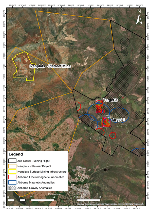
Figure 1: Maps showing the Zeb Nickel Project area, the results of the gravity survey, and the planned EM survey areas over the same geophysical targets adjacent to the Ivanplats ‘Platreef Mine,’ which is expected to become the largest underground platinum mines globally once in full production. The ground-based gravity results correlate well with the airborne gravity, magnetic, and electromagnetic datasets and provide significantly higher resolution. The upcoming ground-based EM survey is intended to determine whether the identified gravity anomalies are conductive, which may indicate the presence of semi-massive to massive sulphide mineralisation.
Request for Quotations
URU is also currently preparing the Request for Quotation documentation for the selection of a drilling contractor. The Company looks forward to updating the market once the contractor selection process has been completed and a preferred contractor has been appointed.
CEO John Zorbas commented:
“The commencement of the ground-based electromagnetic survey marks another important step in advancing the Zeb Nickel Project. Following the encouraging results from the gravity survey, this next phase will allow us to further refine the conductive anomalies and better understand their potential to host semi-massive to massive nickel sulphide mineralisation.
“We are very excited about the progress being made and look forward to the coming weeks as the FDEM survey progresses. We will continue to provide shareholders with regular updates as results are received and interpreted, further strengthening our pipeline of high-quality drill targets.”
About the Company
URU Metals is a mineral exploration and development company focused on advancing high-potential critical metals projects in South Africa. The Company is committed to creating sustainable value through responsible mining practices, regulatory compliance, and active stakeholder engagement. For more information, visit www.urumetals.com
For further information, please contact:
URU Metals Limited
John Zorbas
(Chief Executive Officer)
+1 416 504 3978
SP Angel Corporate Finance LLP
(Nominated Adviser and Broker)
Ewan Leggat / Caroline Rowe + 44 (0) 203 470 0470
#FDR First Development Resources PLC – Selta: Geophysical Interpretation & Drill Planning
 First Development Resources plc (AIM: FDR), the UK-based, Australia-focused mineral exploration company with interests in the Northern Territory and Western Australia, is pleased to announce preliminary results from recently completed geophysical surveys at the Lander West gold (“Au”) target, part of the Company’s 100%-owned Selta Project located in the Northern Territory, Australia.
The geophysical surveys comprised high-resolution airborne magnetics (“AMAG”), radiometrics (“RAD”) and ground-based Gradient Array Induced Polarisation (“GAIP”). These datasets have been integrated with geological, geochemical and historical drilling data to refine the Company’s understanding of the project area and support the design of a maiden Reverse Circulation (“RC”) drilling programme.
The planned drilling is designed to test structurally controlled and intrusion-related Au mineralisation associated with the regionally significant Stafford Gold Trend.
HIGHLIGHTS
· Integrated geological, geophysical and geochemical interpretation has significantly refined the structural and lithological model for Au targeting at Lander West.
· Key geological features identified include granitic contacts beneath thin sand cover, interpreted buried intrusions, major shear zones, faults and fold structures-features known to host significant Au mineralisation both in Australia and globally.
· Phase I RC drilling programme of up to ~3,000 metres, to be executed in two sub-phases comprising an initial c.2,000 metre programme targeting approximately 10 priority drillholes, followed by a flexible c.1,000 metre follow-up phase subject to field observations and results.
Tristan Pottas, Chief Executive Officer of FDR, commented:
“The completion of this integrated geophysical survey programme represents a significant step forward in defining high-quality drill targets for Au at Lander West. By combining new high-resolution magnetic, radiometric and IP datasets with existing geological and geochemical information, we have materially improved our understanding of the structural architecture controlling mineralisation.
Importantly, the recent survey work has identified a compelling combination of shear-related and intrusion-related Au targets, including a large interpreted buried granite body that may have acted as a heat and fluid source driving mineralisation.
The presence of multiple high-priority targets associated with major structures within the Stafford Gold Trend provides strong confidence as we advance to our maiden RC drilling programme. We now look forward to drill testing these targets and unlocking the project’s potential.”
INTEGRATED INTERPRETATION AND TARGETING
Following completion of the GAIP survey, FDR’s Perth-based consultants, Resource Potentials Pty Ltd (“ResPot”), undertook an integrated review of all available datasets, including AMAG, RAD, GAIP, geochemistry and historical drilling.
This work has significantly improved the definition of the geological architecture at Lander West (Figure 1), which is largely concealed beneath shallow sedimentary cover. Interpretation is ongoing to identify additional Au targets.
Key interpreted features include:
· Contacts between prospective granite bodies and surrounding metasedimentary and volcanic host rocks,
· Buried granitic intrusions, plugs and porphyry dyke systems,
· Major shear zones and fault structures,
· Fold axes, dipping limbs and structural corridors, and
· Younger mafic dyke intrusions post-dating the Au mineralising event.
The mineralised corridors are interpreted to lie between two large granite batholiths, likely acting as heat sources driving hydrothermal fluid flow and forming shear-hosted Au systems. Historical shallow drilling suggests a stronger association with the northern batholith, while structural control is evident in the southern target area.
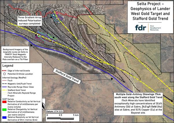
Figure 1:Interpreted large-scale structural controls on the Lander West gold targets. Interpretation of these structures has been further refined following the recent completion of AMAG / RAD and GAIP geophysical surveys by FDR.
INTRUSION-RELATED GOLD SYSTEM TARGETING
Geophysical interpretation has identified a large intrusion-related target zone in the northern licence area. This is interpreted as a buried granitic batholith beneath thin sedimentary cover, previously unmapped and unexplored for Au and other minerals such as copper (“Cu”) and lithium (“Li”), despite anomalous geochemistry in historical shallow drilling.
This interpretation is supported by:
· Magnetic and radiometric responses consistent with felsic intrusive rocks, interpreted as late-stage and comparable in age to “fertile” granites in the region,
· A coincident regional gravity low, and
· Supporting topographic signatures from digital elevation and geological datasets.
These features are consistent with a late granite intrusion potentially associated with Au, antimony (“Sb”), Li and rare-earth elements (“REE”).
Additional smaller felsic porphyry stocks and dykes have also been identified. Where felsic intrusive rocks are intersected during drilling, selective sampling may be undertaken to support potential age-dating and further geological analysis.
ROLE OF THE GAIP SURVEY
The GAIP survey has provided key subsurface information on conductivity and chargeability, aiding identification of structures and potential sulphide mineralisation associated with Au deposition.
It has been particularly effective in confirming:
· Shear zones,
· Lithological boundaries, and
· Structural corridors
These are critical target zones for both shear-hosted and intrusion-related Au systems.
Drilling results will be used to calibrate GAIP responses against mineralisation, improving its effectiveness as a targeting tool.
PHASE I RC DRILL PROGRAMME DESIGN
A maiden Phase I RC drilling programme has been designed as a staged programme of up to ~3,000 metres, comprising an initial priority sub-phase followed by a flexible follow-up phase.
The programme is expected to commence with an initial sub-phase targeting approximately 10 high-priority drillholes (c.2,000 metres). These holes have been selected based on integrated geological, geophysical and geochemical datasets and are designed to test the most prospective structural and intrusion-related Au targets.
A second, follow-up sub-phase of up to c.1,000 metres has been provisionally planned, comprising additional drillholes that will be refined and prioritised based on observations and results from the initial drilling. These follow-up holes are therefore considered flexible and subject to change as new data is acquired during the programme.
In total, the current drill plan comprises up to 16 holes for approximately 3,000 metres; however, the final number, positioning and depth of drillholes will remain adaptable as the programme progresses.
Targets include:
· Major structural zones (shears, faults, fold “jogs”) coincident with geochemical anomalies,
· Edges of magnetic anomalies interpreted as intrusive bodies in contact with host rocks (including skarn and intrusion-related targets), and the structural controls related to them,
· Coincident GAIP chargeability and magnetic anomaly zones interpreted to be caused by hydrothermal alteration associated with both shear and intrusion-related Au targets, and
· Anomalous Au and arsenic (“As”) results from previous shallow drilling.
Drill collar locations have been optimised using integrated datasets (Figure 2), with flexibility retained to refine targets as results from the initial sub-phase are received.
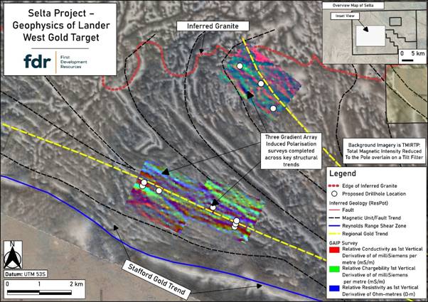
Figure 2: Lander West Phase I RC drill hole locations (white dots), which have been optimised following integration of AMAG / RAD and GAIP geophysical survey results.
CONTEXT WITHIN THE STAFFORD GOLD TREND
Lander West lies within the Stafford Gold Trend, a regionally significant structural corridor known for hosting Au and Sb mineralisation, as well as recently discovered high-grade Li pegmatites.
Exploration 15-20 km to the southeast has reported results of up to 30.6% Sb and 24 g/t Au.
The Company is targeting:
· Shear-hosted Au mineralisation within the Stafford Gold Trend, and
· Intrusion-related Au systems associated with felsic intrusions to the north.
The combination of a large interpreted late granite intrusive system and well-developed structural controls significantly enhance prospectivity and supports the Company’s maiden drill campaign.
NEXT STEPS
· Final planning and drilling contractor engagement,
· Earthworks clearing of approved access routes and drill pads,
· Mobilisation and commencement of the Phase I RC drilling programme, targeted for mid-year, with all necessary approvals now secured, including the Environmental (Mining) Licence and the Northern Territory Government’s Notice of Authority to Commence, and
· Ongoing geological and geophysical interpretation and refinement of targets during drilling.
The Company looks forward to commencing its maiden RC drilling programme at Lander West and will update shareholders as preparations are finalised and the drilling commences.
Qualified Person Statement
The technical information contained in this disclosure has been reviewed and approved by Mr Nicholas O’Reilly (MSc, DIC, MIMMM QMR, MAusIMM, FGS), who is a qualified geologist and acts as the Qualified Person under the AIM Rules – Note for Mining and Oil & Gas Companies. Mr O’Reilly is a principal consultant working for Mining Analyst Consulting Ltd which has been retained by First Development Resources plc to provide technical support.
GLOSSARY
|
Term |
Definition |
|
AMAG (Airborne Magnetics) |
A geophysical survey method that measures variations in the Earth’s magnetic field from the air to map subsurface geological structures. |
|
Arsenic (As) |
A chemical element commonly associated with Au mineralisation and used as a pathfinder in geochemical exploration. |
|
Batholith |
A large, deep-seated body of intrusive igneous rock, typically granitic in composition. |
|
Chargeability |
A measure of a material’s ability to temporarily hold an electrical charge, often used to detect sulphide mineralisation in IP surveys. |
|
Conductivity |
The ability of a material to conduct electrical current, used in geophysics to identify different rock types and alteration zones. |
|
Copper (Cu) |
A base metal often associated with hydrothermal systems and sometimes co-located with Au mineralisation. |
|
Dyke |
A sheet-like body of igneous rock that cuts across existing rock layers. |
|
Felsic |
A term describing silica-rich igneous rocks, typically light-coloured and commonly associated with granitic compositions. |
|
Fold |
A bend or curvature in rock layers caused by tectonic forces. |
|
GAIP (Gradient Array Induced Polarisation) |
A ground-based geophysical method that measures chargeability and resistivity to identify subsurface structures and sulphide mineralisation. |
|
Geochemistry |
The study of the chemical composition of rocks, soils and sediments to identify anomalous element concentrations. |
|
Geophysics |
The application of physical measurement techniques to investigate subsurface geological features. |
|
Granite |
A coarse-grained felsic intrusive igneous rock commonly associated with mineralising systems. |
|
Hydrothermal |
Relating to hot fluids circulating within the Earth’s crust that can transport and deposit minerals. |
|
Intrusion (Intrusive Body) |
A body of igneous rock formed when magma solidifies beneath the Earth’s surface. |
|
Intrusion-Related Gold System |
A type of mineral system where Au mineralisation is genetically linked to felsic intrusive rocks. |
|
Lithology |
The physical characteristics and composition of a rock unit. |
|
Lithological Boundary |
The contact between two different rock types. |
|
Lithium (Li) |
A light metal commonly found in pegmatites and increasingly important for battery technologies. |
|
Magnetic Anomaly |
A local variation in the Earth’s magnetic field caused by differences in the magnetic properties of subsurface rocks. |
|
Mafic |
Describes igneous rocks rich in magnesium and iron, typically darker in colour. |
|
Metasediments |
Sedimentary rocks that have been altered by heat and pressure without melting. |
|
Mineralisation |
The process by which economically valuable minerals are introduced into a rock. |
|
Pegmatite |
A very coarse-grained igneous rock often enriched in rare elements such as Li and REE. |
|
Porphyry |
An igneous rock with large crystals set in a finer-grained groundmass, often associated with mineral deposits. |
|
Radiometrics (RAD) |
A geophysical method that measures natural gamma radiation to identify variations in surface and near-surface geology. |
|
Rare Earth Elements (REE) |
A group of chemically similar elements used in high-technology applications and often found in specialised mineral deposits. |
|
RC (Reverse Circulation) Drilling |
A drilling technique that uses compressed air to return rock chips to the surface for sampling. |
|
Resistivity |
A measure of how strongly a material resists electrical current, used to differentiate rock types and structures. |
|
Shear Zone |
A zone of intense deformation where rocks have been displaced along a planar structure. |
|
Shear-Hosted Gold System |
A type of Au deposit controlled by deformation zones such as faults and shear zones. |
|
Skarn |
A calc-silicate rock formed by metasomatic alteration, often associated with mineralisation near intrusions. |
|
Structural Corridor |
A zone of aligned geological structures that can control the movement of mineralising fluids. |
|
Structure (Geological) |
Any feature in rocks formed by deformation, such as faults, folds or shear zones. |
|
Sulphide Mineralisation |
The occurrence of sulphide minerals, often associated with metal deposits including Au. |
|
Target (Exploration Target) |
A geological area identified as having potential to host mineralisation based on available data. |
|
Uranium (U) |
A radioactive element used as a fuel source and often explored for in sedimentary and igneous environments. |
For further information visit www.firstdevelopmentresources.com or contact the following:
|
First Development Resources plc Tristan Pottas (CEO) |
Tel: +44 (0) 20 3778 1397 |
|
Beaumont Cornish Limited Nominated Adviser Roland Cornish / Asia Szusciak |
Tel: +44 (0) 20 7628 3396 |
|
SI Capital Limited Broker Nick Emerson
|
Tel: +44 (0) 1483 413 500 |
#URU URU Metals Ltd – Completion of Gravity Survey
 URU Metals Limited (“URU” or the “Company”) is pleased to announce the completion of the ground-based gravity survey over priority targets at the Zeb Nickel Project, with results demonstrating strong correlation with previously identified airborne electromagnetic and magnetic anomalies.
Gravity Survey Programme
The gravity survey was completed over Targets 1 and 2, previously identified as the highest-priority anomalies from the Spectrem airborne electromagnetic survey. The programme was conducted on a 50 m x 50 m grid using high-precision CG5 gravimeters, with data quality reported as ‘very good’ following full Bouguer correction and processing.
The objective of the ground-based gravity survey was to enhance the resolution of the airborne datasets and improve the definition of potential drill targets associated with semi-massive nickel sulphide mineralisation.
Gravity Results
The results of the gravity survey are highly encouraging and provide improved confidence in the geological interpretation:
Target 1
· The Spectrem electromagnetic anomaly correlates closely with a residual gravity high, confirming that the target is both conductive and relatively dense.
· The gravity anomaly extends beyond the electromagnetic (“EM”) footprint, suggesting the presence of dense ultramafic rocks and/or sulphide accumulation zones.
· This strong coincidence of conductivity and density is considered highly prospective for nickel sulphide mineralisation.
Target 2
· A weak but distinct gravity high (~0.1 mGal) coincides with the southern portion of the northern EM anomaly.
· This gravity feature also aligns well with a first vertical derivative (1VD) magnetic anomaly, reinforcing the validity of the target.
· While the response may represent a dense ultramafic unit such as a harzburgite pulse, the combined conductive, dense, and magnetic signature is also consistent with potential sulphide mineralisation.
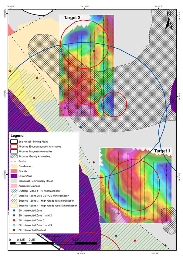 Figure 1: Maps showing the ground-based gravity results for the two target areas overlain on a mapped and interpreted geological map. The results align well with the results from the airborne data and provide higher resolution compared to the airborne gravity survey.
Interpretation and Next Steps
The ground-based gravity results align closely with the airborne datasets but provide a significantly higher level of resolution, allowing for better definition of anomaly geometry and depth.
These results:
· Confirm the presence of coincident conductive and dense targets
· Improve confidence in the interpreted magmatic conduit system
· Provide a stronger technical basis for drill targeting
The frequency-domain electromagnetic survey is expected to commence shortly, which will further refine the conductive responses and support final drill target prioritisation.
The Zeb Nickel Project is strategically located on the Northern Limb of the Bushveld Complex, adjacent to the Ivanplats Platreef Project, which is expected to become one of the largest underground platinum group metal operations globally once fully operational.
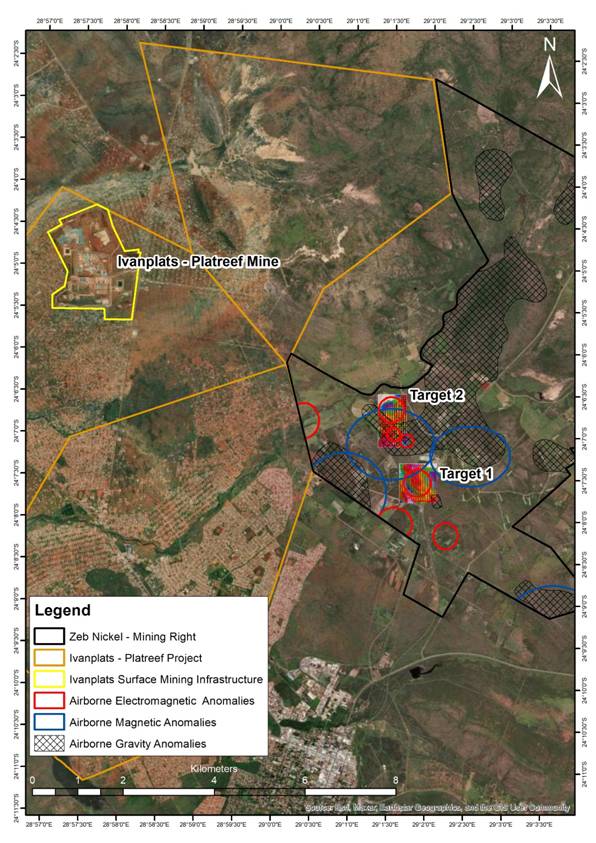
Figure 2: Maps showing the Zeb Nickel Project area and the geophysical targets adjacent to the Ivanplats “Platreef Mine,” which is expected to become one of the largest underground platinum mines globally once in full production.
CEO John Zorbas commented:
“We are very encouraged by the results of the ground-based gravity survey, which show strong correlation with the airborne electromagnetic and magnetic datasets. The improved resolution of the ground survey provides greater confidence in the interpretation of these anomalies and enhances our ability to focus on the most prospective semi-massive and massive nickel sulphide targets.
“The responses observed at Targets 1 and 2 are particularly compelling, displaying the coincident conductive and dense signatures often associated with sulphide mineralisation. With the EM survey set to commence shortly, we look forward to further refining these targets ahead of drilling.
“We are very excited about the progress being made and the momentum building at the Zeb Nickel Project. We look forward to the coming weeks and months and will continue to update shareholders regularly as results become available.”
About the Company
URU Metals is a mineral exploration and development company focused on advancing high-potential critical metals projects in South Africa. The Company is committed to creating sustainable value through responsible mining practices, regulatory compliance, and active stakeholder engagement. For more information, visit www.urumetals.com
Market Abuse Regulation (MAR) Disclosure
This announcement contains inside information for the purposes of Article 7 of the Market Abuse Regulation (EU) No. 596/2014 as it forms part of United Kingdom domestic law by virtue of the European Union (Withdrawal) Act 2018 (“UK MAR”). Upon the publication of this announcement via a Regulatory Information Service, this inside information is now considered to be in the public domain.
For further information, please contact:
URU Metals Limited
John Zorbas
(Chief Executive Officer)
+1 416 504 3978
SP Angel Corporate Finance LLP
(Nominated Adviser and Broker)
Ewan Leggat / Caroline Rowe / Devik Mehta + 44 (0) 203 470 0470
#BRES Blencowe Resources PLC – Beehive Drilling Results
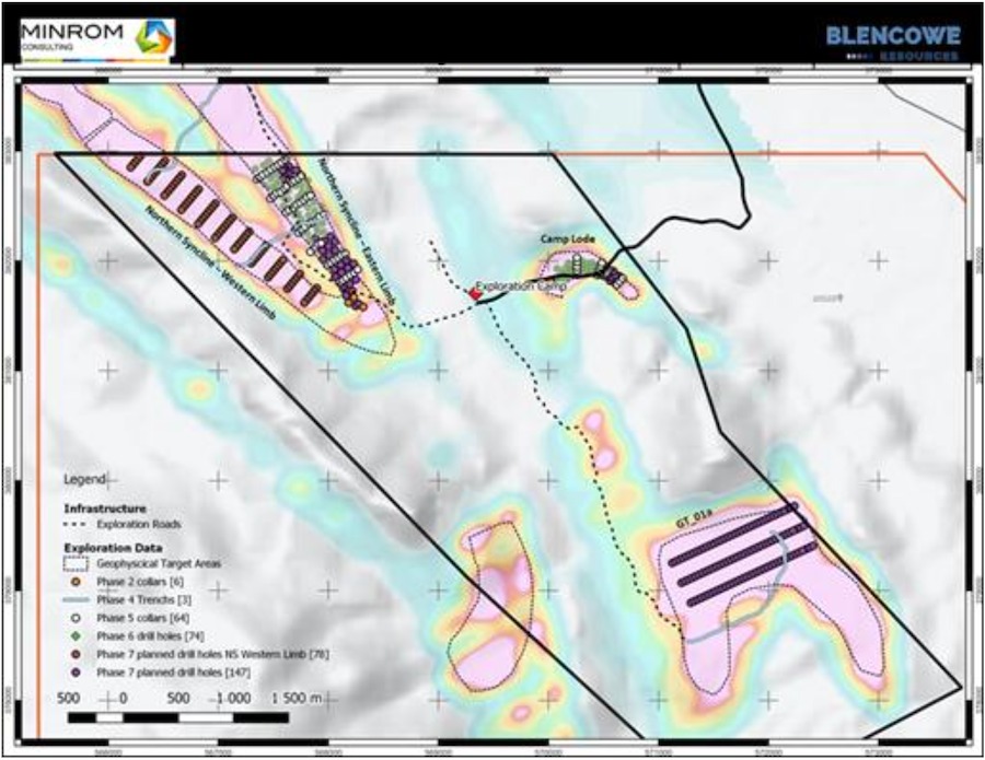 Blencowe Resources Plc (LSE: BRES) is pleased to provide an update on further assay results from shallow drilling at the company’s new Beehive deposit. Both Beehive and Iyan are substantial new exploration finds within the most recent 2025 drill programme and both will contribute significantly to the size and scale of the Orom-Cross graphite project.
As part of the Stage 7 drilling programme, the Company completed 110 shallow drill holes at Beehive, designed to test the continuity, thickness and near-surface extent of graphite mineralisation. This announcement reports further assay results from 36 holes (including additional coverage toward the northern extent), following the Company’s previous Beehive assay update.
The shallow programme was designed to define near-surface, bulk mineable graphite mineralisation, with holes drilled to a planned depth of approximately 30 metres. The majority of reported holes intersected graphite mineralisation from near surface to end-of-hole, with many holes ending in mineralisation, highlighting potential for continuation below the current shallow drilling depth. This is consistent with previously reported deeper drilling at Beehive, which demonstrated graphite mineralisation continuing to approximately 100 metres depth.
Whilst the drilling was intended to close out the northern extent of the deposit, results also indicate potential for additional extensions of up to ~400m – particularly toward the northern and western end of the deposit – within the broader target area.
Beehive Drilling Highlights
An additional 36 assay results were received and compiled from the Stage 7 programme:
· Thick near-surface mineralisation: multiple holes deliver ~30-32 meters mineralisation from surface, supporting depth continuity and bulk mining potential.
· Strong bulk grades across the batch: 12 holes average ≥5.0% TGC and 8 holes average ≥6.0% TGC over the drilled intervals highlighting strong in situ grades within Beehive.
· High-grade frequency: all holes are mineralised and grades are consistently higher than overall average grades for other deposits within Orom-Cross.
Selected Beehive Significant Shallow Intercepts Include:
o BHDD-L101: 31.5 meters @ 8.19% TGC from surface
o BHDD-L111: 31.4 meters @ 8.00% TGC from surface
o BHDD-L327: 31.2 meters @ 7.67% TGC from surface
o BHDD-L113: 31.92 meters @ 7.59% TGC from surface, including 9.32m @ 11.14% TGC
o BHDD-L133: 31.4 meters @ 6.83% TGC from surface
o BHDD-L102: 29.61 meters @ 6.11% TGC from surface
o BHDD-L325: 31.3 meters @ 6.21% TGC from surface
Interpretation and Next Steps
These additional shallow results continue to support a thick graphite system at shallow depths, while previously reported deeper drilling has demonstrated mineralisation continuing to approximately 100 metres depth. Together, this work is building the dataset required to define the near-surface component and progress modelling toward a maiden Beehive JORC Mineral Resource scheduled for Q2 2026.
Further Beehive assay batches are being passed directly to the Company’s independent geological consultants, Minrom, for validation and quality assurance. Results will be reported progressively as batches are cleared and, subject to modelling, are intended to support a future Beehive JORC Mineral Resource update and provide further clarity on overall scale and development readiness as Blencowe continues to progress strategic and funding discussions in parallel.
Beehive has been defined over approximately 1,200 metres of strike and 480 metres of width to date, with scope for extensions beyond the current drill lines.
Blencowe Resources Executive Chairman, Cameron Pearce commented:
“We are pleased to report a further batch of Beehive assay results and appreciate shareholders’ patience as results move through laboratory reporting and independent validation. We expect a further set of assay results to become available shortly and will provide updates as batches are cleared.
Beehive continues to build momentum. This further batch reinforces continuity at shallow depths, with multiple plus-30 meter intercepts from surface and standout results including 31.5m @ 8.19% TGC and 31.4m @ 8.00% TGC.
Following the recent maiden Iyan JORC Mineral Resource of 16.9 million tonnes, which increased total Orom-Cross JORC Mineral Resources by 66% to 43.0 million tonnes, Beehive remains the next clear growth lever as we progress toward a maiden Beehive JORC Mineral Resource update this quarter. We would expect the continuity and thickness being demonstrated at Beehive to translate into a material increase in overall tonnage, subject to completion of assay flow, modelling and JORC reporting.
With access to renewable hydroelectric power and an expanding resource base, Orom-Cross continues to be positioned as an integral part of the western markets’ drive for secure, non-China critical mineral supply chains, supporting downstream pathways and longer-term offtake discussions.”
Beehive Deposit – Key Drill Results
Figures 1-2: Beehive Deposit drill sections showing thick, continuous graphite mineralisation remaining open at depth.
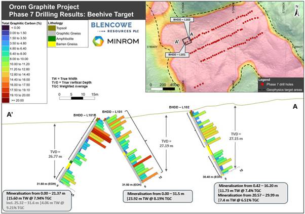
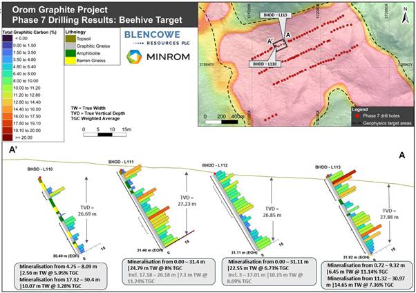
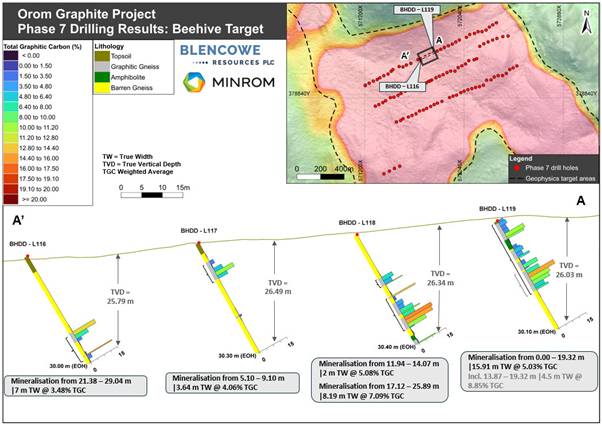
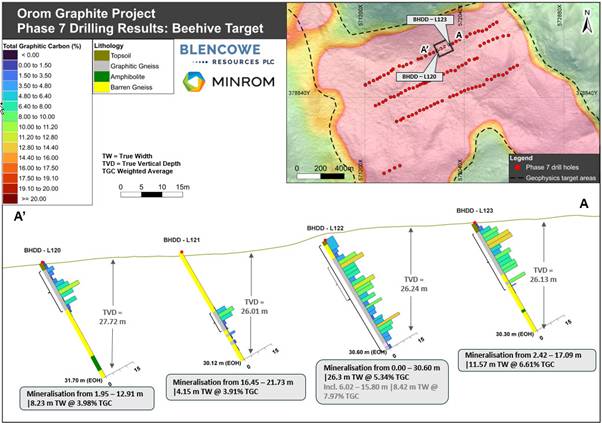
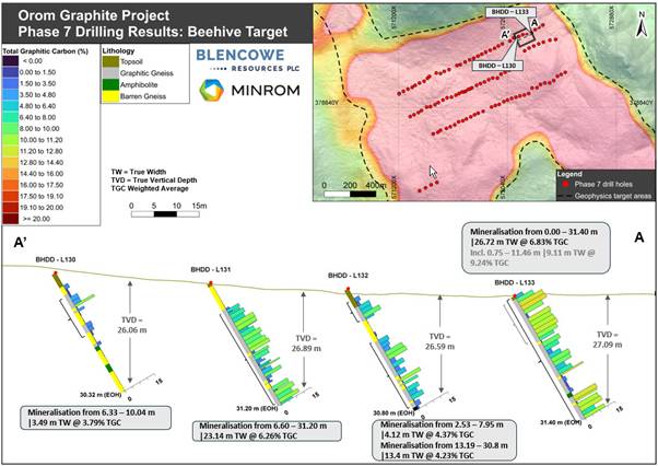
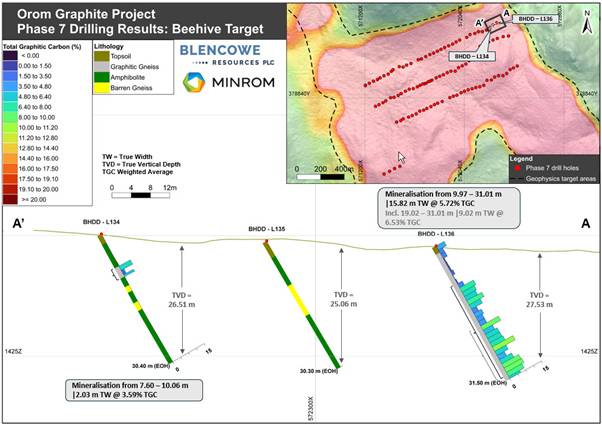
|
Blencowe Resources Plc |
|
|
Sam Quinn (Director) |
Tel: +44 (0)1624 681 250
|
|
Sasha Sethi (Investor Relations) |
Tel: +44 (0) 7891 677 441 |
|
Tavira Financial (Joint Broker)
Jonathan Evans |
Tel: +44 (0)20 3192 1733 |
|
Oak Securities (Joint Broker)
Calvin Man /Mungo Sheehan / Jerry Keen |
Tel: +44 (0)20 3973 3678 |
|
|
|
|
|
#BRES Blencowe Resources PLC – Beehive Drilling Returns Multiple 30m Intercepts
Blencowe Resources Plc (LSE: BRES) is pleased to provide an update on the first set of assay results from shallow drilling at the Beehive deposit, one of the two exciting new deposits recently delineated at the Company’s Orom-Cross graphite project in Uganda.
As part of the Stage 7 drilling programme, the Company completed 110 shallow drill holes at Beehive, designed to test the continuity, thickness and near-surface extent of graphite mineralisation across the deposit. This announcement reports assay results received to date from an initial 35 holes (BHDD-L201 to BHDD-L236), which are considered representative of the broader drilling programme, and they make up the central line on the drilling program. This line also contained the three deeper holes drilled to 120m as part of the programme, ther results of which were very successful and reported earlier.
Highlights (first 35 Beehive holes)
· Thick near-surface mineralisation: multiple holes deliver +30 metre intercepts from surface, supporting bulk-mineable near-surface potential near to planned processing facilities.
· High-Grade Frequency: 15 holes average >6.0% TGC and 18 holes average >5.0% TGC over the entire hole
· Standout results:
o BHDD-L209; 30.09 metres @ 10.78% TGC from surface.
o BHDD-L207; 31.4 metres @ 9.46% TGC from surface.
· Newsflow: further Beehive assay batches are now with the Company’s independent geological consultants, Minrom, for validation and quality assurance. As batches are cleared additional results are expected in quick succession and will be reported progressively
· Strategic context: following the maiden Iyan JORC Mineral Resource of 16.9Mt, which lifted total Orom-Cross JORC Mineral Resources by 66% to 43.0Mt, Beehive represents the next key growth lever as development planning and strategic/funding discussions progress in parallel
(TGC refers to Total Graphitic Carbon. Intervals below represent composited grades over the drilled interval from surface to end-of-hole for the shallow programme.)
Selected Significant Shallow Intercepts – Beehive Deposit
|
Hole ID |
Interval (m) |
Grade (% TGC) |
|
BHDD-L209 |
30.09 |
10.78 |
|
BHDD-L207 |
31.40 |
9.46 |
|
BHDD-L217 |
31.40 |
9.16 |
|
BHDD-L214 |
31.40 |
8.29 |
|
BHDD-L208 |
31.40 |
8.22 |
|
BHDD-L206 |
30.20 |
8.19 |
|
BHDD-L211 |
30.10 |
7.75 |
|
BHDD-L210 |
31.29 |
7.60 |
|
BHDD-L205 |
31.30 |
7.23 |
|
BHDD-L212 |
31.40 |
7.16 |
|
BHDD-L236 |
30.00 |
6.85 |
|
BHDD-L213 |
31.19 |
6.66 |
|
BHDD-L218 |
30.31 |
6.48 |
Notes: Intervals represent the drilled interval composited from surface to end-of-hole depth for the shallow programme. Additional results from the programme will be reported as received and validated.
The shallow Beehive drilling was deliberately designed to define near-surface, bulk mineable graphite mineralisation, with holes drilled to a planned depth of approximately 30 metres. Importantly, the majority of results reported include multiple holes delivering +30 metres of continuous graphite mineralisation from near surface with many holes ending in mineralisation, highlighting clear potential for continuation below the current drilling depth. These results build on previously reported deeper drilling at Beehive, which demonstrated graphite mineralisation continuing to around 100 metres depth (where all deep holes also ended in mineralisation).
Interpretation and Next Steps
These initial Beehive results support the interpretation of a substantial new deposit with a thick graphite system at shallow depths, while previously reported deep drilling has demonstrated that mineralisation can continue to over 100 metres depth. The shallow holes are therefore helping define near-surface tonnage, with deeper drilling indicating clear vertical upside.
Orom-Cross is a vast bulk-tonnage system that continues to demonstrate multiple higher-grade zones within its broader mineralised envelope, providing flexibility for mine planning, blending and value optimisation as the development plan is refined. This combination of scale, consistency and grade-profile is increasingly relevant to downstream processing pathways and longer-term offtake discussions, particularly as Western markets continue to prioritise secure, diversified non-China supply chains.
Further Beehive assay results are expected shortly and are currently with the Company’s independent geological consultants Minrom for validation and quality assurance. Results will be reported progressively with subsequent batches expected in quick succession and, subject to modelling, are expected to support a further JORC Mineral Resource Estimate update for the Beehive deposit thus providing additional clarity on overall scale, mine life and development readiness as Blencowe continues to progress strategic and funding discussions.
Beehive has been defined over approximately 1,200 metres of strike and 480 metres of width to date, with scope for extensions to the east, west, north and south beyond the current drill lines, plus at depth. Blencowe believes that just a fraction of this deposit has been drilled to date, hence the upside potential is substantial.
Blencowe’s CEO, Mike Ralston discussed these results and other work underway with FocusIR on the link below:
https://media.focusir.com/BlencoweBeehiveDrillResults
Blencowe Resources Executive Chairman, Cameron Pearce commented:
“Beehive is delivering strong early validation, including 30.09 metres at 10.78% TGC from surface, and multiple +30 metre intercepts from surface across the initial dataset. These results reinforce the potential for meaningful near-surface tonnage within the broader Orom-Cross system.
Following our recent maiden Iyan JORC Mineral Resource of 16.9 million tonnes, which increased total Orom-Cross JORC Mineral Resources by 66% to 43.0 million tonnes, the strategic importance of adding further tonnes here at Beehive is clear: constantly strengthening Orom-Cross as a scalable, multi-deposit graphite system capable of supporting several downstream pathways.
With access to renewable hydropower and a growing resource base, Orom-Cross is being positioned as an integral part of the West’s drive for secure, non-China critical mineral supply. Further Beehive assay batches are now with Minrom for validation, and as batches are cleared we expect additional results to be reported in quick succession, progressing towards a maiden Beehive JORC Mineral Resource in due course, and a further update to the overall Orom-Cross JORC Mineral Resource.
We continue to advance strategic and funding discussions in parallel as development planning progresses.”
Beehive Deposit – Key Drill Results
Figures 1-2: Beehive Deposit drill sections showing thick, continuous graphite mineralisation remaining open at depth.
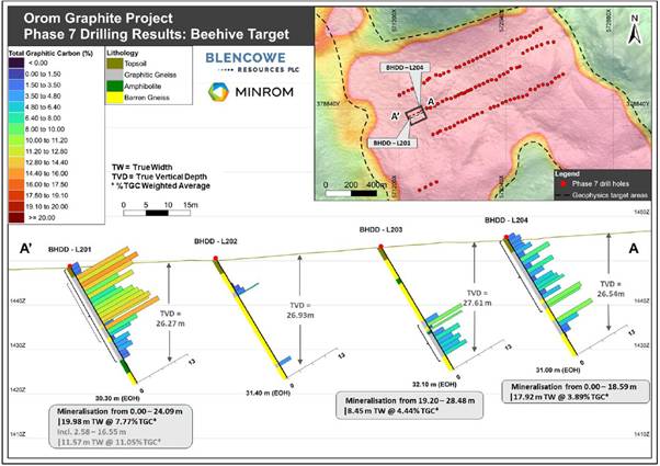
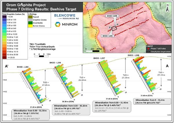
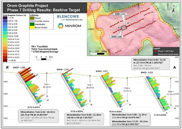
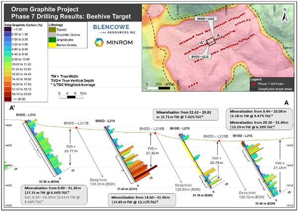
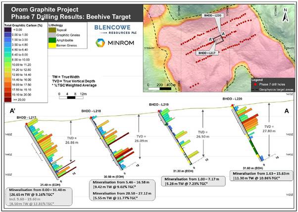
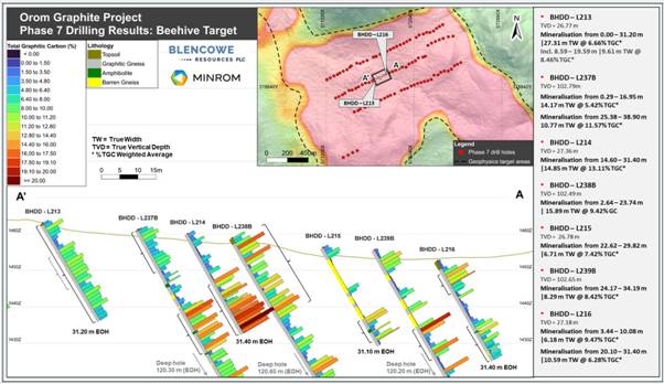
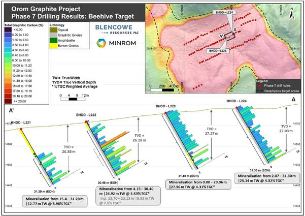
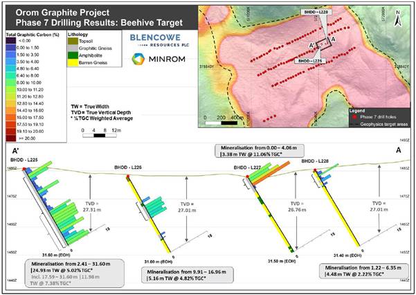
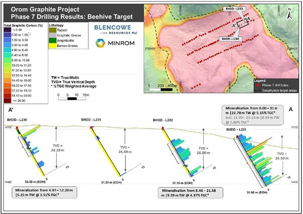
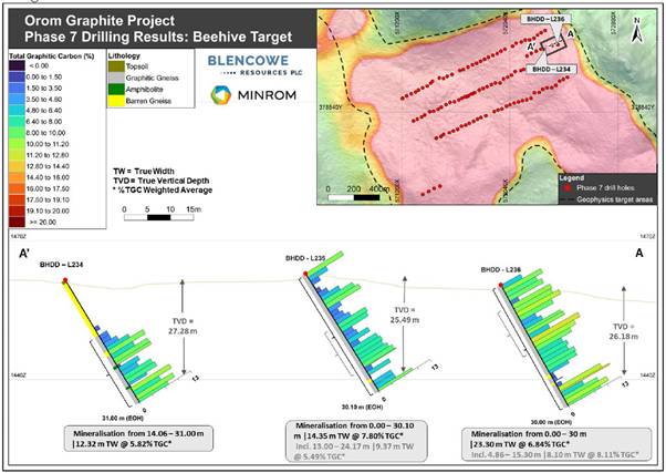
Figure 11: Orom-Cross graphite project showing ML1959 as a part of the overall licensed area.
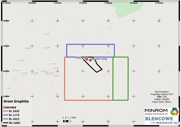
|
Blencowe Resources Plc |
|
|
Sam Quinn (Director) |
Tel: +44 (0)1624 681 250
|
|
Sasha Sethi (Investor Relations) |
Tel: +44 (0) 7891 677 441 |
|
Tavira Financial (Joint Broker)
Jonathan Evans |
Tel: +44 (0)20 3192 1733 |
|
Oak Securities (Joint Broker)
Calvin Man /Mungo Sheehan / Jerry Keen |
Tel: +44 (0)20 3973 3678 |
|
|
|
|
|
Map 1: Showing the 4x Orom-Cross deposits, including Camp Lode, Northern Syncline, and new Iyan (NS western limb) and Beehive (GT 01a) deposits.
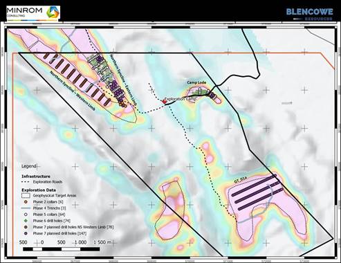
#BRES Blencowe Resources PLC – FINAL IYAN DRILLING RESULTS
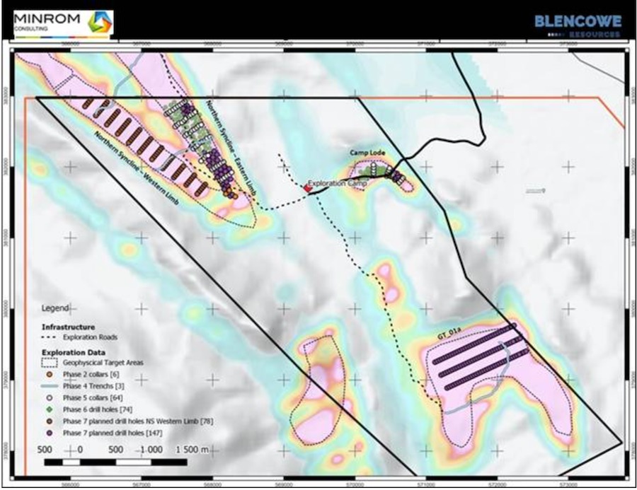 Blencowe Resources Plc (LSE: BRES) is pleased to report the final set of assay results completed from the 87 shallow holes drilled at the Iyan deposit, part of the Company’s Orom-Cross Graphite Project in Uganda. These results represent the third batch from the Stage 7 drilling programme, with results continuing to exceed expectations and supporting the imminent maiden JORC resource estimate for the Iyan deposit, which will increase the overall Orom-Cross resource base. This maiden JORC resource will represent the first formal resource estimate for Iyan and further strengthen Orom-Cross as a multi-deposit graphite project.
This final batch completes the Stage 7 drilling programme at Iyan, providing the last data required for the maiden Iyan JORC Resource estimate, expected shortly.
Iyan forms the western extension of the Northern Syncline graphite system and is being advanced as a bulk blending deposit intended to provide consistent, near-surface, high tonnage graphite feed to support long-life, low-cost production. Results at Orom-Cross continue to demonstrate that the bulk mineralisation at Iyan is accompanied by repeated higher-grade zones, providing flexibility within mine planning for blending and supporting overall project value.
These latest shallow holes were drilled to approximately 30 metres depth, deliberately selected to define near-surface mineable material rather than test geological limits. Mineralisation was intersected from surface in most holes, with several ending in mineralisation, indicating potential for continuation below the current drilling depth. This is consistent with all previous results at Iyan. The northern area highlights some barren intrusions in the upper areas but also indicates strong grade intercepts at depth below the barren overlying materials.
Iyan Drilling – Highlights
· Final assay batch drilling results continue to exceed expectations and support imminent maiden JORC resource estimate for Iyan, increasing the overall Orom-Cross resource base
· Thick, laterally continuous near-surface graphite mineralisation confirmed
· Multiple intercepts of >30m from surface, with several holes ending in mineralisation
· Iyan will be developed as a bulk blending deposit, supporting efficient, low-strip mining
· Higher-grade zones persist within bulk mineralisation, enhancing blending flexibility
· Results support near-term resource growth, larger-scale development and ongoing funding and offtake discussions
· Southern drill lines indicate potential extension of mineralisation toward the Northern Syncline hinge
Selected Significant Shallow Intercepts – Iyan Deposit
(Selected downhole intervals; mineralisation from surface unless stated otherwise)
• NSDD-L103: 15.64m @ 10.13% TGC, including 5.02m @ 14.42% TGC and 1.00m @ 18.37% TGC
• NSDD-L307: 9.44m @ 11.42% TGC, including 4.00m @ 15.96% TGC and 1.00m @ 18.89% TGC
• NSDD-L508: 13.71m @ 8.26% TGC, including 4.01m @ 11.00% TGC (ended in mineralisation)
• NSDD-L503: 10.72m @ 8.18% TGC, including 3.06m @ 12.37% TGC
• NSDD-L408: 9.60m @ 8.95% TGC from surface, including 2.50m @ 13.76% TGC
• NSDD-L402: 10.00m @ 7.96% TGC, including 4.00m @ 10.82% TGC
These results are consistent with the broader Orom-Cross system and support mine planning and the bulk blending strategy,reinforcing the scale and continuity ahead of the maiden Iyan JORC resource estimate.
JORC Update Q1 2026
The final assay results are now being validated and modelled by the independent geological consultants, Minrom, and areexpected to deliver the maiden JORC resource estimate for Iyan in Q1 2026. This will increase the overall Orom-Cross resource and support ongoing funding and offtake discussions as they continue to advance.
Beehive Drilling Results Pending
In parallel, substantial assay results at the nearby Beehive deposit remain pending. Earlier deep drilling returned very strong grades at depths of up to approximately 100 metres. Assay results from the completed shallow drilling programme at Beehive, comprising approximately 110 holes drilled to approximately 30 metres depth, are expected to be reported regularly in batches and are anticipated to further contribute to overall Orom-Cross resource growth, with a maiden JORC resource estimate for Beehive expected to follow.
Blencowe Resources Executive Chairman, Cameron Pearce commented:
“These further great results from Iyan continue to exceed our expectations. We are seeing thick graphite from surface, strong grades, and excellent consistency across the deposit, which is exactly what we need as we build scale at Orom-Cross.
With the maiden Iyan JORC estimate now imminent, these results clearly demonstrate the size and quality of the resource. This is particularly important as we progress funding discussions, as it reinforces the long-life, large-scale development potential of Orom-Cross.
The maiden Iyan JORC will mark another important step in demonstrating the full scale of Orom-Cross.
Importantly, we still have significant upside ahead. Many holes continue to end in mineralisation, and Beehive drilling results remain to come, which we expect will further strengthen the overall resource base.”
Iyan Deposit – Key Drill Results
Figures 1-2: Iyan Deposit drill sections showing thick, continuous graphite mineralisation remaining open at depth, remaining sections 1-5, 7, and 9
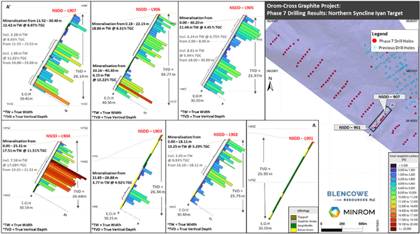
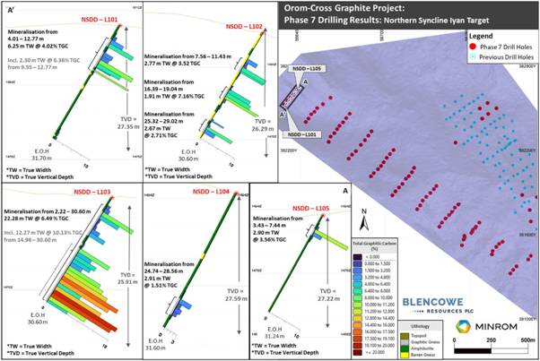
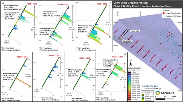
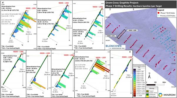
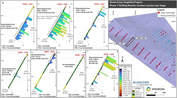
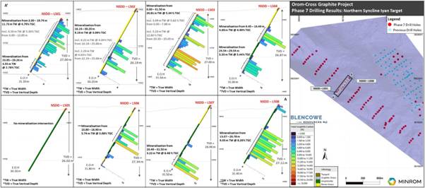
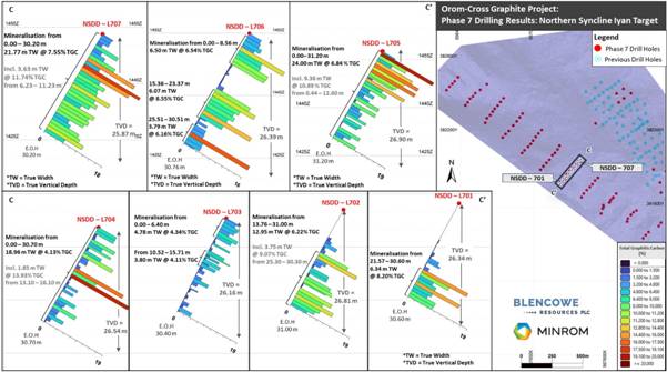
For further information please contact:
|
Blencowe Resources Plc |
|
|
Sam Quinn (Director) |
Tel: +44 (0)1624 681 250
|
|
Sasha Sethi (Investor Relations) |
Tel: +44 (0) 7891 677 441 |
|
Tavira Financial (Joint Broker):
Jonathan Evans |
Tel: +44 (0)20 3192 1733 |
|
Oak Securities (Joint Broker):
Calvin Man /Mungo Sheehan / Jerry Keen |
Tel: +44 (0)20 3973 3678 |
|
|
|
|
|